
North America
Cayman Islands — map and facts
Here you find a map of Cayman Islands, capital George Town, currency Caymansk dollar and quick links to more facts about the country in North America.
About the country
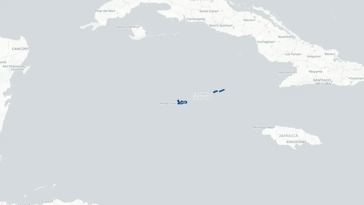
Cayman Islands on the map
About Cayman Islands
The Cayman Islands is a British Overseas Territory located in the western Caribbean Sea, consisting of three islands: Grand Cayman, Cayman Brac, and Little Cayman. George Town, on Grand Cayman, is the capital and administrative centre. The total population is approximately 75,000, including a large expatriate community. As a British Overseas Territory, the Cayman Islands is self-governing in most domestic matters, with the United Kingdom retaining responsibility for defence and foreign affairs. The islands are among the world's most prominent offshore financial centres, hosting thousands of registered hedge funds, banks, and insurance companies. There is no income tax, capital gains tax, or corporation tax, making the jurisdiction exceptionally attractive to international business. The islands are also a popular tourist destination, renowned for pristine diving sites, luxury resorts, and the famous Seven Mile Beach. The Caymanian dollar is the local currency.
Geography and Landscape
The Cayman Islands lie approximately 750 kilometres south of Miami and 290 kilometres northwest of Jamaica. Grand Cayman is by far the largest island, accounting for the vast majority of the land area and population. Cayman Brac and Little Cayman are smaller and more remote. The islands are low-lying, formed primarily from coral limestone, with no significant hills or mountains; the highest point on Grand Cayman reaches only about 18 metres above sea level. The coastline features numerous coral reefs, white sand beaches, and calm turquoise lagoons. The surrounding waters are among the clearest in the Caribbean and support exceptional biodiversity. The climate is tropical, with a warm, wet season from May to October and a drier, slightly cooler season from November to April. Hurricanes are an occasional threat, and the islands lie within the Caribbean hurricane belt. The islands contain various wetland habitats, including mangrove forests important to local ecology.
History
The Cayman Islands were first recorded by Europeans when Christopher Columbus sighted them in 1503, noting the abundance of turtles and naming the area Las Tortugas. They were later renamed after the caiman crocodiles reported by early visitors. The islands remained uninhabited by Europeans until the late seventeenth century when settlers, including English and Welsh immigrants and shipwrecked sailors, began arriving. The islands were formally ceded to Britain under the 1670 Treaty of Madrid and were administered as a dependency of Jamaica until Jamaican independence in 1962, after which the Cayman Islands became a separate Crown Colony. A new constitution introduced in 2009 gave the islands greater autonomy. From the 1960s onwards the islands developed their financial services sector dramatically, becoming one of the world's foremost offshore financial centres by the late twentieth century. Today the Cayman Islands balances its role as a global financial hub with a thriving tourism industry.
Geo Quiz
Think you know your capitals, flags, and continents? Take the quiz!
Neighbouring countries
Continue to nearby countries
There are no registered neighbouring countries for Cayman Islands in the current database.
More countries in the same part of the world
North America index
Open the continent hub for North America to see the full country list, capitals and frequently asked questions on one page.
Interactive map
Zoomable map of Cayman Islands
Country index
All countries by continent
Jump directly to the right section or keep scrolling.
Africa
58 countries- Algeria
- Angola
- Benin
- Botswana
- Burkina Faso
- Burundi
- Central African Republic
- Djibouti
- Democratic Republic of the Congo
- Egypt
- Equatorial Guinea
- Ivory Coast
- Eritrea
- Ethiopia
- Gabon
- Gambia
- Ghana
- Guinea
- Guinea-Bissau
- Cameroon
- Cape Verde
- Kenya
- Comoros
- Republic of the Congo
- Lesotho
- Liberia
- Libya
- Madagascar
- Malawi
- Mali
- Morocco
- Mauritania
- Mauritius
- Mayotte
- Mozambique
- Namibia
- Niger
- Nigeria
- Reunion
- Rwanda
- Saint Helena
- Sao Tome and Principe
- Senegal
- Seychelles
- Sierra Leone
- Somalia
- Sudan
- Swaziland
- South Africa
- South Sudan
- Tanzania
- Chad
- Togo
- Tunisia
- Uganda
- Western Sahara
- Zambia
- Zimbabwe
Asia
52 countries- Afghanistan
- Armenia
- Azerbaijan
- Bahrain
- Bangladesh
- Bhutan
- British Indian Ocean Territory
- Brunei
- Myanmar
- Philippines
- United Arab Emirates
- Georgia
- Hong Kong
- India
- Indonesia
- Iraq
- Iran
- Israel
- Japan
- Yemen
- Jordan
- Christmas Island
- Cambodia
- Kazakhstan
- China
- Kyrgyzstan
- Cocos Islands
- Kuwait
- Laos
- Lebanon
- Macau
- Malaysia
- Maldives
- Mongolia
- Nepal
- North Korea
- Oman
- Pakistan
- Palestinian Territory
- Qatar
- Saudi Arabia
- Singapore
- Sri Lanka
- South Korea
- Syria
- Tajikistan
- Taiwan
- Thailand
- Turkey
- Turkmenistan
- Uzbekistan
- Vietnam
Europe
53 countries- Albania
- Andorra
- Belgium
- Bosnia and Herzegovina
- Bulgaria
- Cyprus
- Denmark
- Estonia
- Finland
- France
- Faroe Islands
- Gibraltar
- Greece
- Guernsey
- Ireland
- Iceland
- Isle of Man
- Italy
- Jersey
- Kosovo
- Croatia
- Latvia
- Liechtenstein
- Lithuania
- Luxembourg
- Macedonia
- Malta
- Moldova
- Monaco
- Montenegro
- Netherlands
- Norway
- Poland
- Portugal
- Romania
- Russia
- San Marino
- Switzerland
- Serbia
- Slovakia
- Slovenia
- Spain
- United Kingdom
- Svalbard and Jan Mayen
- Sweden
- Czech Republic
- Germany
- Ukraine
- Hungary
- Vatican
- Belarus
- Aland Islands
- Austria
North America
42 countries- U.S. Virgin Islands
- Anguilla
- Antigua and Barbuda
- Aruba
- Bahamas
- Barbados
- Belize
- Bermuda
- Bonaire, Saint Eustatius and Saba
- British Virgin Islands
- Cayman Islands
- Costa Rica
- Curacao
- Dominica
- Dominican Republic
- El Salvador
- Grenada
- Greenland
- Guadeloupe
- Guatemala
- Haiti
- Honduras
- Jamaica
- Canada
- Cuba
- Martinique
- Mexico
- Montserrat
- Netherlands Antilles
- Nicaragua
- Panama
- Puerto Rico
- Saint Barthelemy
- Saint Kitts and Nevis
- Saint Lucia
- Saint Martin
- Saint Vincent and the Grenadines
- Saint Pierre and Miquelon
- Sint Maarten
- Trinidad and Tobago
- Turks and Caicos Islands
- United States
South America
14 countriesOceania
27 countries- American Samoa
- Australia
- Cook Islands
- Fiji
- French Polynesia
- United States Minor Outlying Islands
- Guam
- Kiribati
- Marshall Islands
- Micronesia
- Nauru
- Niue
- Northern Mariana Islands
- Norfolk Island
- New Caledonia
- New Zealand
- Palau
- Papua New Guinea
- Pitcairn
- Solomon Islands
- Samoa
- Tokelau
- Tonga
- Tuvalu
- Vanuatu
- Wallis and Futuna
- East Timor