
South America
Ecuador — map and facts
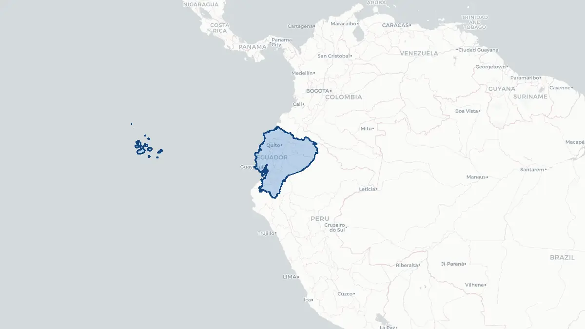
Here you find a map of Ecuador, capital Quito, currency US Dollar and quick links to more facts about the country in South America.
About the country
Ecuador on the map
About Ecuador
Ecuador is a country on the northwestern coast of South America, straddling the equator — from which it takes its name. It borders Colombia to the north, Peru to the east and south, and the Pacific Ocean to the west. The population is approximately 18 million. The capital is Quito, a UNESCO World Heritage city situated high in the Andes at about 2,850 metres above sea level. The largest city by population is Guayaquil, the country's main port on the Pacific coast. Ecuador is a presidential republic. The country is one of the world's top exporters of bananas and shrimp; petroleum from the Amazon basin has historically been the leading export commodity. The Galápagos Islands, a UNESCO World Heritage Site some 900 kilometres off the coast, are both an iconic natural reserve and a major driver of high-end tourism. Ecuador adopted the US dollar as its currency in 2000 following a severe banking crisis and economic collapse in the late 1990s.
Geography and Landscape
Ecuador is divided into four distinct regions: the Costa (Pacific coastal lowlands), the Sierra (Andean highlands), the Oriente (Amazon basin), and the Galápagos Islands. The Andes run down the centre of the country in two parallel ranges — the Cordillera Occidental and the Cordillera Oriental — separated by the Inter-Andean Valley, sometimes called the "Avenue of the Volcanoes" because of its remarkable concentration of active and dormant peaks. Chimborazo (6,263 m) is the highest volcano and — measured from Earth's centre — the farthest point from Earth's core on the planet's surface. Cotopaxi (5,897 m) is one of the world's highest active volcanoes. The Amazon tributary system drains the eastern slopes, with major rivers including the Napo and the Pastaza. The Pacific coast is characterised by mangroves and tropical forest. The Galápagos Islands are volcanic in origin and straddle the equator, hosting unique endemic wildlife that inspired Charles Darwin's theory of natural selection.
History
The territory of present-day Ecuador was home to several pre-Columbian cultures, most notably the Quitu-Cara and later the Cañari, before the Inca Empire expanded northward and incorporated the region in the late fifteenth century under Huayna Capac. The Inca city of Tomebamba, near present-day Cuenca, was a major administrative centre. Spanish conquistadors under Sebastián de Belalcázar conquered the region in 1534, founding Quito on the ruins of an Inca settlement. Ecuador formed part of the Viceroyalty of Peru and later the Viceroyalty of New Granada. The independence movement gained momentum after the Primer Grito de Independencia on 10 August 1809 in Quito — now celebrated as national day — and Ecuador achieved full independence after the Battle of Pichincha on 24 May 1822. It joined Simón Bolívar's Gran Colombia, then separated as an independent republic in 1830. The twentieth century was marked by territorial conflicts with Peru, alternating civilian and military governments, and, in recent decades, a left-leaning political realignment under Rafael Correa (2007–2017).
Geo Quiz
Think you know your capitals, flags, and continents? Take the quiz!
Neighbouring countries
Continue to nearby countries
More countries in the same part of the world
South America index
Open the continent hub for South America to see the full country list, capitals and frequently asked questions on one page.
Interactive map
Zoomable map of Ecuador
Country index
All countries by continent
Jump directly to the right section or keep scrolling.
Africa
58 countries- Algeria
- Angola
- Benin
- Botswana
- Burkina Faso
- Burundi
- Central African Republic
- Djibouti
- Democratic Republic of the Congo
- Egypt
- Equatorial Guinea
- Ivory Coast
- Eritrea
- Ethiopia
- Gabon
- Gambia
- Ghana
- Guinea
- Guinea-Bissau
- Cameroon
- Cape Verde
- Kenya
- Comoros
- Republic of the Congo
- Lesotho
- Liberia
- Libya
- Madagascar
- Malawi
- Mali
- Morocco
- Mauritania
- Mauritius
- Mayotte
- Mozambique
- Namibia
- Niger
- Nigeria
- Reunion
- Rwanda
- Saint Helena
- Sao Tome and Principe
- Senegal
- Seychelles
- Sierra Leone
- Somalia
- Sudan
- Swaziland
- South Africa
- South Sudan
- Tanzania
- Chad
- Togo
- Tunisia
- Uganda
- Western Sahara
- Zambia
- Zimbabwe
Asia
52 countries- Afghanistan
- Armenia
- Azerbaijan
- Bahrain
- Bangladesh
- Bhutan
- British Indian Ocean Territory
- Brunei
- Myanmar
- Philippines
- United Arab Emirates
- Georgia
- Hong Kong
- India
- Indonesia
- Iraq
- Iran
- Israel
- Japan
- Yemen
- Jordan
- Christmas Island
- Cambodia
- Kazakhstan
- China
- Kyrgyzstan
- Cocos Islands
- Kuwait
- Laos
- Lebanon
- Macau
- Malaysia
- Maldives
- Mongolia
- Nepal
- North Korea
- Oman
- Pakistan
- Palestinian Territory
- Qatar
- Saudi Arabia
- Singapore
- Sri Lanka
- South Korea
- Syria
- Tajikistan
- Taiwan
- Thailand
- Turkey
- Turkmenistan
- Uzbekistan
- Vietnam
Europe
53 countries- Albania
- Andorra
- Belgium
- Bosnia and Herzegovina
- Bulgaria
- Cyprus
- Denmark
- Estonia
- Finland
- France
- Faroe Islands
- Gibraltar
- Greece
- Guernsey
- Ireland
- Iceland
- Isle of Man
- Italy
- Jersey
- Kosovo
- Croatia
- Latvia
- Liechtenstein
- Lithuania
- Luxembourg
- Macedonia
- Malta
- Moldova
- Monaco
- Montenegro
- Netherlands
- Norway
- Poland
- Portugal
- Romania
- Russia
- San Marino
- Switzerland
- Serbia
- Slovakia
- Slovenia
- Spain
- United Kingdom
- Svalbard and Jan Mayen
- Sweden
- Czech Republic
- Germany
- Ukraine
- Hungary
- Vatican
- Belarus
- Aland Islands
- Austria
North America
42 countries- U.S. Virgin Islands
- Anguilla
- Antigua and Barbuda
- Aruba
- Bahamas
- Barbados
- Belize
- Bermuda
- Bonaire, Saint Eustatius and Saba
- British Virgin Islands
- Cayman Islands
- Costa Rica
- Curacao
- Dominica
- Dominican Republic
- El Salvador
- Grenada
- Greenland
- Guadeloupe
- Guatemala
- Haiti
- Honduras
- Jamaica
- Canada
- Cuba
- Martinique
- Mexico
- Montserrat
- Netherlands Antilles
- Nicaragua
- Panama
- Puerto Rico
- Saint Barthelemy
- Saint Kitts and Nevis
- Saint Lucia
- Saint Martin
- Saint Vincent and the Grenadines
- Saint Pierre and Miquelon
- Sint Maarten
- Trinidad and Tobago
- Turks and Caicos Islands
- United States
South America
14 countriesOceania
27 countries- American Samoa
- Australia
- Cook Islands
- Fiji
- French Polynesia
- United States Minor Outlying Islands
- Guam
- Kiribati
- Marshall Islands
- Micronesia
- Nauru
- Niue
- Northern Mariana Islands
- Norfolk Island
- New Caledonia
- New Zealand
- Palau
- Papua New Guinea
- Pitcairn
- Solomon Islands
- Samoa
- Tokelau
- Tonga
- Tuvalu
- Vanuatu
- Wallis and Futuna
- East Timor