
Africa
Mayotte — map and facts
Here you find a map of Mayotte, capital Mamoudzou, currency Euro and quick links to more facts about the country in Africa.
About the country
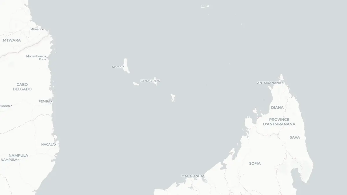
Mayotte on the map
#### About Mayotte Mayotte is a French overseas department and region situated in the Indian Ocean, positioned in the northern Mozambique Channel between the eastern coast of Mozambique and the northwestern tip of Madagascar. Its capital is Mamoudzou, located on the main island of Grande-Terre. With a population exceeding 320,000, Mayotte is one of the most densely populated French territories and one of the poorest departments in France. The island archipelago consists of two main islands, Grande-Terre and Petite-Terre, along with numerous smaller islets. As a department of France, Mayotte is also part of the European Union. The population is predominantly Muslim and maintains strong cultural connections with the Comorian islands that surround it. Mayotte has one of the youngest populations in France and has experienced rapid demographic growth driven in large part by immigration, including significant numbers of undocumented migrants from the neighboring Comoros islands.
#### Geography and Landscape Mayotte consists of a volcanic archipelago enclosed within one of the largest lagoons in the world, a barrier reef system stretching approximately 195 kilometers that encompasses around 1,100 square kilometers of turquoise water. Grande-Terre, the larger main island, is mountainous and heavily forested, with its highest point, Mount Bénara, reaching 660 meters. The island's terrain features deep valleys, dramatic ridgelines, and a coastline cut by mangrove-lined estuaries. Petite-Terre, sometimes called Pamandzi, is much smaller and hosts the island's main airport. The lagoon enclosed by the barrier reef is renowned for its exceptional marine biodiversity, including coral gardens, sea turtles, dugongs, and humpback whales that use the warm protected waters for breeding. The island experiences a tropical climate with a hot, wet season from November to April and a cooler, drier season from May to October.
#### History Mayotte and the surrounding Comorian archipelago were settled by successive waves of Bantu, Malay, and Arab peoples from roughly the fifth century onward, giving rise to a distinctive Swahili-influenced culture. Arab traders played a significant role in the region from the ninth century, and Islam became established as the dominant religion by the 15th century. France began establishing influence over Mayotte in 1841 when the island's sultan, Andriantsoly, ceded it to France in exchange for protection from rival chieftains. France gradually extended its control over the broader Comoros archipelago through the late 19th century. When the Comoros voted for independence in a 1974 referendum, Mayotte was alone in voting to remain with France, setting the stage for a long administrative dispute. The island eventually became a French departmental collectivity in 2001 and achieved full overseas department status in 2011, making it the 101st department of France and the newest member of the European Union's outermost regions.
Geo Quiz
Think you know your capitals, flags, and continents? Take the quiz!
Neighbouring countries
Continue to nearby countries
There are no registered neighbouring countries for Mayotte in the current database.
More countries in the same part of the world
Africa index
Open the continent hub for Africa to see the full country list, capitals and frequently asked questions on one page.
Interactive map
Zoomable map of Mayotte
Country index
All countries by continent
Jump directly to the right section or keep scrolling.
Africa
58 countries- Algeria
- Angola
- Benin
- Botswana
- Burkina Faso
- Burundi
- Central African Republic
- Djibouti
- Democratic Republic of the Congo
- Egypt
- Equatorial Guinea
- Ivory Coast
- Eritrea
- Ethiopia
- Gabon
- Gambia
- Ghana
- Guinea
- Guinea-Bissau
- Cameroon
- Cape Verde
- Kenya
- Comoros
- Republic of the Congo
- Lesotho
- Liberia
- Libya
- Madagascar
- Malawi
- Mali
- Morocco
- Mauritania
- Mauritius
- Mayotte
- Mozambique
- Namibia
- Niger
- Nigeria
- Reunion
- Rwanda
- Saint Helena
- Sao Tome and Principe
- Senegal
- Seychelles
- Sierra Leone
- Somalia
- Sudan
- Swaziland
- South Africa
- South Sudan
- Tanzania
- Chad
- Togo
- Tunisia
- Uganda
- Western Sahara
- Zambia
- Zimbabwe
Asia
52 countries- Afghanistan
- Armenia
- Azerbaijan
- Bahrain
- Bangladesh
- Bhutan
- British Indian Ocean Territory
- Brunei
- Myanmar
- Philippines
- United Arab Emirates
- Georgia
- Hong Kong
- India
- Indonesia
- Iraq
- Iran
- Israel
- Japan
- Yemen
- Jordan
- Christmas Island
- Cambodia
- Kazakhstan
- China
- Kyrgyzstan
- Cocos Islands
- Kuwait
- Laos
- Lebanon
- Macau
- Malaysia
- Maldives
- Mongolia
- Nepal
- North Korea
- Oman
- Pakistan
- Palestinian Territory
- Qatar
- Saudi Arabia
- Singapore
- Sri Lanka
- South Korea
- Syria
- Tajikistan
- Taiwan
- Thailand
- Turkey
- Turkmenistan
- Uzbekistan
- Vietnam
Europe
53 countries- Albania
- Andorra
- Belgium
- Bosnia and Herzegovina
- Bulgaria
- Cyprus
- Denmark
- Estonia
- Finland
- France
- Faroe Islands
- Gibraltar
- Greece
- Guernsey
- Ireland
- Iceland
- Isle of Man
- Italy
- Jersey
- Kosovo
- Croatia
- Latvia
- Liechtenstein
- Lithuania
- Luxembourg
- Macedonia
- Malta
- Moldova
- Monaco
- Montenegro
- Netherlands
- Norway
- Poland
- Portugal
- Romania
- Russia
- San Marino
- Switzerland
- Serbia
- Slovakia
- Slovenia
- Spain
- United Kingdom
- Svalbard and Jan Mayen
- Sweden
- Czech Republic
- Germany
- Ukraine
- Hungary
- Vatican
- Belarus
- Aland Islands
- Austria
North America
42 countries- U.S. Virgin Islands
- Anguilla
- Antigua and Barbuda
- Aruba
- Bahamas
- Barbados
- Belize
- Bermuda
- Bonaire, Saint Eustatius and Saba
- British Virgin Islands
- Cayman Islands
- Costa Rica
- Curacao
- Dominica
- Dominican Republic
- El Salvador
- Grenada
- Greenland
- Guadeloupe
- Guatemala
- Haiti
- Honduras
- Jamaica
- Canada
- Cuba
- Martinique
- Mexico
- Montserrat
- Netherlands Antilles
- Nicaragua
- Panama
- Puerto Rico
- Saint Barthelemy
- Saint Kitts and Nevis
- Saint Lucia
- Saint Martin
- Saint Vincent and the Grenadines
- Saint Pierre and Miquelon
- Sint Maarten
- Trinidad and Tobago
- Turks and Caicos Islands
- United States
South America
14 countriesOceania
27 countries- American Samoa
- Australia
- Cook Islands
- Fiji
- French Polynesia
- United States Minor Outlying Islands
- Guam
- Kiribati
- Marshall Islands
- Micronesia
- Nauru
- Niue
- Northern Mariana Islands
- Norfolk Island
- New Caledonia
- New Zealand
- Palau
- Papua New Guinea
- Pitcairn
- Solomon Islands
- Samoa
- Tokelau
- Tonga
- Tuvalu
- Vanuatu
- Wallis and Futuna
- East Timor