
South America
French Guiana — map and facts
Here you find a map of French Guiana, capital Cayenne, currency Euro and quick links to more facts about the country in South America.
About the country
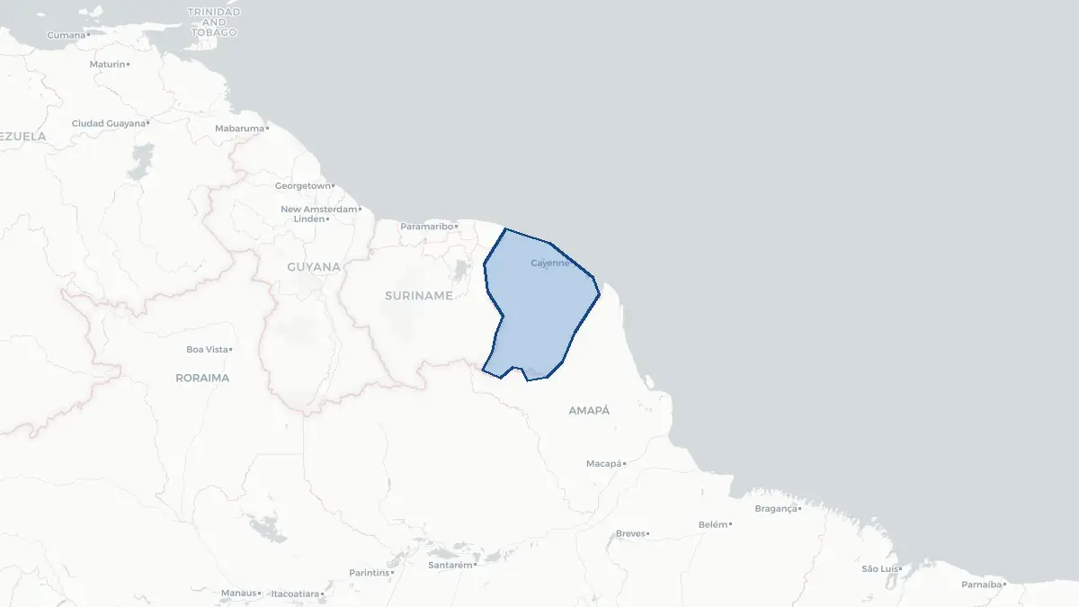
French Guiana on the map
About French Guiana
French Guiana is an overseas region and department of France, located on the northeastern coast of South America, bordered by Brazil to the south and east and Suriname to the west. It is the only territory of the European Union on the mainland of South America. The capital is Cayenne, and the total population is approximately 300,000, though estimates vary due to significant undocumented migration. As an integral part of France, French Guiana uses the euro and its residents are French citizens with full voting rights in French national elections. The territory is governed by both a departmental council and a regional council. The economy is dominated by the French state, with the European Space Agency's Guiana Space Centre at Kourou representing a major employer and a significant source of revenue. Aerospace, forestry, fishing, and small-scale gold mining are other economic activities. Poverty rates remain high relative to metropolitan France.
Geography and Landscape
French Guiana covers approximately 84,000 square kilometres, making it the largest of France's overseas regions. The territory is dominated by dense equatorial rainforest, which covers more than 90 percent of the land area and is part of the vast Amazon basin ecosystem. The terrain rises from a narrow coastal plain to the interior highlands, with the Tumuc-Humac Mountains forming the southern border with Brazil. The Maroni River marks the border with Suriname to the west, and numerous rivers drain the interior. The climate is equatorial and humid, with two wet and two dry seasons annually and rainfall exceeding 3,000 millimetres in many areas. Biodiversity is exceptional, with thousands of plant species, jaguars, tapirs, harpy eagles, and river dolphins. The Guiana Amazonian Park, established in 2007, is one of the largest national parks in the world and protects a vast portion of the pristine interior rainforest.
History
The region was inhabited by Amerindian peoples for thousands of years before European arrival. French colonists attempted to settle the coast from the early seventeenth century, but repeated failures, tropical disease, and conflict with indigenous peoples impeded permanent settlement. The French established firmer control in the mid-seventeenth century, and the colony developed a plantation economy based on enslaved African labour. French Guiana was briefly occupied by the Portuguese during the Napoleonic Wars. From 1852 to 1953 it served as a penal colony, with the infamous Devil's Island offshore becoming a symbol of harsh French penal practices. The Dreyfus Affair drew international attention to Devil's Island in the 1890s. After the abolition of the penal colony, the territory experienced economic stagnation before being administratively integrated into France in 1946 as an overseas department. The establishment of the Guiana Space Centre at Kourou in 1968 gave the territory renewed strategic importance.
Geo Quiz
Think you know your capitals, flags, and continents? Take the quiz!
Neighbouring countries
Continue to nearby countries
More countries in the same part of the world
South America index
Open the continent hub for South America to see the full country list, capitals and frequently asked questions on one page.
Interactive map
Zoomable map of French Guiana
Country index
All countries by continent
Jump directly to the right section or keep scrolling.
Africa
58 countries- Algeria
- Angola
- Benin
- Botswana
- Burkina Faso
- Burundi
- Central African Republic
- Djibouti
- Democratic Republic of the Congo
- Egypt
- Equatorial Guinea
- Ivory Coast
- Eritrea
- Ethiopia
- Gabon
- Gambia
- Ghana
- Guinea
- Guinea-Bissau
- Cameroon
- Cape Verde
- Kenya
- Comoros
- Republic of the Congo
- Lesotho
- Liberia
- Libya
- Madagascar
- Malawi
- Mali
- Morocco
- Mauritania
- Mauritius
- Mayotte
- Mozambique
- Namibia
- Niger
- Nigeria
- Reunion
- Rwanda
- Saint Helena
- Sao Tome and Principe
- Senegal
- Seychelles
- Sierra Leone
- Somalia
- Sudan
- Swaziland
- South Africa
- South Sudan
- Tanzania
- Chad
- Togo
- Tunisia
- Uganda
- Western Sahara
- Zambia
- Zimbabwe
Asia
52 countries- Afghanistan
- Armenia
- Azerbaijan
- Bahrain
- Bangladesh
- Bhutan
- British Indian Ocean Territory
- Brunei
- Myanmar
- Philippines
- United Arab Emirates
- Georgia
- Hong Kong
- India
- Indonesia
- Iraq
- Iran
- Israel
- Japan
- Yemen
- Jordan
- Christmas Island
- Cambodia
- Kazakhstan
- China
- Kyrgyzstan
- Cocos Islands
- Kuwait
- Laos
- Lebanon
- Macau
- Malaysia
- Maldives
- Mongolia
- Nepal
- North Korea
- Oman
- Pakistan
- Palestinian Territory
- Qatar
- Saudi Arabia
- Singapore
- Sri Lanka
- South Korea
- Syria
- Tajikistan
- Taiwan
- Thailand
- Turkey
- Turkmenistan
- Uzbekistan
- Vietnam
Europe
53 countries- Albania
- Andorra
- Belgium
- Bosnia and Herzegovina
- Bulgaria
- Cyprus
- Denmark
- Estonia
- Finland
- France
- Faroe Islands
- Gibraltar
- Greece
- Guernsey
- Ireland
- Iceland
- Isle of Man
- Italy
- Jersey
- Kosovo
- Croatia
- Latvia
- Liechtenstein
- Lithuania
- Luxembourg
- Macedonia
- Malta
- Moldova
- Monaco
- Montenegro
- Netherlands
- Norway
- Poland
- Portugal
- Romania
- Russia
- San Marino
- Switzerland
- Serbia
- Slovakia
- Slovenia
- Spain
- United Kingdom
- Svalbard and Jan Mayen
- Sweden
- Czech Republic
- Germany
- Ukraine
- Hungary
- Vatican
- Belarus
- Aland Islands
- Austria
North America
42 countries- U.S. Virgin Islands
- Anguilla
- Antigua and Barbuda
- Aruba
- Bahamas
- Barbados
- Belize
- Bermuda
- Bonaire, Saint Eustatius and Saba
- British Virgin Islands
- Cayman Islands
- Costa Rica
- Curacao
- Dominica
- Dominican Republic
- El Salvador
- Grenada
- Greenland
- Guadeloupe
- Guatemala
- Haiti
- Honduras
- Jamaica
- Canada
- Cuba
- Martinique
- Mexico
- Montserrat
- Netherlands Antilles
- Nicaragua
- Panama
- Puerto Rico
- Saint Barthelemy
- Saint Kitts and Nevis
- Saint Lucia
- Saint Martin
- Saint Vincent and the Grenadines
- Saint Pierre and Miquelon
- Sint Maarten
- Trinidad and Tobago
- Turks and Caicos Islands
- United States
South America
14 countriesOceania
27 countries- American Samoa
- Australia
- Cook Islands
- Fiji
- French Polynesia
- United States Minor Outlying Islands
- Guam
- Kiribati
- Marshall Islands
- Micronesia
- Nauru
- Niue
- Northern Mariana Islands
- Norfolk Island
- New Caledonia
- New Zealand
- Palau
- Papua New Guinea
- Pitcairn
- Solomon Islands
- Samoa
- Tokelau
- Tonga
- Tuvalu
- Vanuatu
- Wallis and Futuna
- East Timor