
North America
Puerto Rico — map and facts
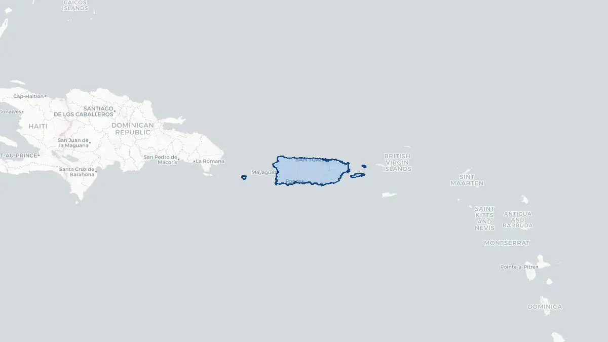
Here you find a map of Puerto Rico, capital San Juan, currency US Dollar and quick links to more facts about the country in North America.
About the country
Puerto Rico on the map
About Puerto Rico
Puerto Rico is an unincorporated territory of the United States located in the northeastern Caribbean Sea, situated between the Dominican Republic to the west and the U.S. Virgin Islands to the east. Its capital and largest city is San Juan. The island's population is approximately 3.2 million, though significant emigration—particularly following Hurricane Maria in 2017—has reduced the resident population in recent years. Puerto Ricans are U.S. citizens by birth under the Jones-Shafroth Act of 1917 but cannot vote in presidential elections while residing on the island. The territory has its own elected governor and legislature but operates under U.S. federal law. The economy has faced severe challenges, including a prolonged debt crisis, austerity measures overseen by a federal oversight board, and the devastation of Hurricane Maria. Key economic sectors include pharmaceuticals, manufacturing, tourism, and rum production. Cultural identity is distinctly Puerto Rican, blending Taíno, Spanish, and African heritage.
Geography and Landscape
Puerto Rico is the smallest of the Greater Antilles, covering approximately 9,104 square kilometres. The main island is roughly rectangular, about 175 kilometres long and 60 kilometres wide. A central mountain range, the Cordillera Central, runs east to west, with the highest peak, Cerro de Punta, reaching 1,338 metres. The northern coastal plain is karst limestone terrain dotted with sinkholes, caves, and haystack hills known as mogotes—most spectacularly visible in the Karst Country around Arecibo. The southern coastal plain is drier and flatter. Puerto Rico also includes the smaller islands of Vieques and Culebra to the east, as well as Mona Island to the west. The climate is tropical, warm year-round, with a rainy season from April to November. The island sits within the Atlantic hurricane belt and has experienced several catastrophic storms.
History
Puerto Rico was inhabited by the Taíno people when Christopher Columbus arrived in 1493 on his second voyage. Spanish colonization began in earnest with Juan Ponce de León, who established the first permanent European settlement in 1508. The island served as a strategic colonial outpost; San Juan's fortifications—El Morro and San Cristóbal—were built to defend it from competing European powers. The indigenous population was decimated by disease and colonial exploitation, and enslaved Africans were brought to work sugar plantations. Puerto Rico and Cuba were Spain's last Caribbean colonies; following the Spanish-American War, Spain ceded Puerto Rico to the United States in 1898 under the Treaty of Paris. The island became a Commonwealth (Estado Libre Asociado) in 1952, granting it a degree of self-governance. Ongoing debates about statehood, independence, or enhanced autonomy remain central to Puerto Rican political life.
Geo Quiz
Think you know your capitals, flags, and continents? Take the quiz!
Neighbouring countries
Continue to nearby countries
There are no registered neighbouring countries for Puerto Rico in the current database.
More countries in the same part of the world
North America index
Open the continent hub for North America to see the full country list, capitals and frequently asked questions on one page.
Interactive map
Zoomable map of Puerto Rico
Country index
All countries by continent
Jump directly to the right section or keep scrolling.
Africa
58 countries- Algeria
- Angola
- Benin
- Botswana
- Burkina Faso
- Burundi
- Central African Republic
- Djibouti
- Democratic Republic of the Congo
- Egypt
- Equatorial Guinea
- Ivory Coast
- Eritrea
- Ethiopia
- Gabon
- Gambia
- Ghana
- Guinea
- Guinea-Bissau
- Cameroon
- Cape Verde
- Kenya
- Comoros
- Republic of the Congo
- Lesotho
- Liberia
- Libya
- Madagascar
- Malawi
- Mali
- Morocco
- Mauritania
- Mauritius
- Mayotte
- Mozambique
- Namibia
- Niger
- Nigeria
- Reunion
- Rwanda
- Saint Helena
- Sao Tome and Principe
- Senegal
- Seychelles
- Sierra Leone
- Somalia
- Sudan
- Swaziland
- South Africa
- South Sudan
- Tanzania
- Chad
- Togo
- Tunisia
- Uganda
- Western Sahara
- Zambia
- Zimbabwe
Asia
52 countries- Afghanistan
- Armenia
- Azerbaijan
- Bahrain
- Bangladesh
- Bhutan
- British Indian Ocean Territory
- Brunei
- Myanmar
- Philippines
- United Arab Emirates
- Georgia
- Hong Kong
- India
- Indonesia
- Iraq
- Iran
- Israel
- Japan
- Yemen
- Jordan
- Christmas Island
- Cambodia
- Kazakhstan
- China
- Kyrgyzstan
- Cocos Islands
- Kuwait
- Laos
- Lebanon
- Macau
- Malaysia
- Maldives
- Mongolia
- Nepal
- North Korea
- Oman
- Pakistan
- Palestinian Territory
- Qatar
- Saudi Arabia
- Singapore
- Sri Lanka
- South Korea
- Syria
- Tajikistan
- Taiwan
- Thailand
- Turkey
- Turkmenistan
- Uzbekistan
- Vietnam
Europe
53 countries- Albania
- Andorra
- Belgium
- Bosnia and Herzegovina
- Bulgaria
- Cyprus
- Denmark
- Estonia
- Finland
- France
- Faroe Islands
- Gibraltar
- Greece
- Guernsey
- Ireland
- Iceland
- Isle of Man
- Italy
- Jersey
- Kosovo
- Croatia
- Latvia
- Liechtenstein
- Lithuania
- Luxembourg
- Macedonia
- Malta
- Moldova
- Monaco
- Montenegro
- Netherlands
- Norway
- Poland
- Portugal
- Romania
- Russia
- San Marino
- Switzerland
- Serbia
- Slovakia
- Slovenia
- Spain
- United Kingdom
- Svalbard and Jan Mayen
- Sweden
- Czech Republic
- Germany
- Ukraine
- Hungary
- Vatican
- Belarus
- Aland Islands
- Austria
North America
42 countries- U.S. Virgin Islands
- Anguilla
- Antigua and Barbuda
- Aruba
- Bahamas
- Barbados
- Belize
- Bermuda
- Bonaire, Saint Eustatius and Saba
- British Virgin Islands
- Cayman Islands
- Costa Rica
- Curacao
- Dominica
- Dominican Republic
- El Salvador
- Grenada
- Greenland
- Guadeloupe
- Guatemala
- Haiti
- Honduras
- Jamaica
- Canada
- Cuba
- Martinique
- Mexico
- Montserrat
- Netherlands Antilles
- Nicaragua
- Panama
- Puerto Rico
- Saint Barthelemy
- Saint Kitts and Nevis
- Saint Lucia
- Saint Martin
- Saint Vincent and the Grenadines
- Saint Pierre and Miquelon
- Sint Maarten
- Trinidad and Tobago
- Turks and Caicos Islands
- United States
South America
14 countriesOceania
27 countries- American Samoa
- Australia
- Cook Islands
- Fiji
- French Polynesia
- United States Minor Outlying Islands
- Guam
- Kiribati
- Marshall Islands
- Micronesia
- Nauru
- Niue
- Northern Mariana Islands
- Norfolk Island
- New Caledonia
- New Zealand
- Palau
- Papua New Guinea
- Pitcairn
- Solomon Islands
- Samoa
- Tokelau
- Tonga
- Tuvalu
- Vanuatu
- Wallis and Futuna
- East Timor