
North America
Greenland — map and facts
Here you find a map of Greenland, capital Nuuk, currency Danska kronor and quick links to more facts about the country in North America.
About the country
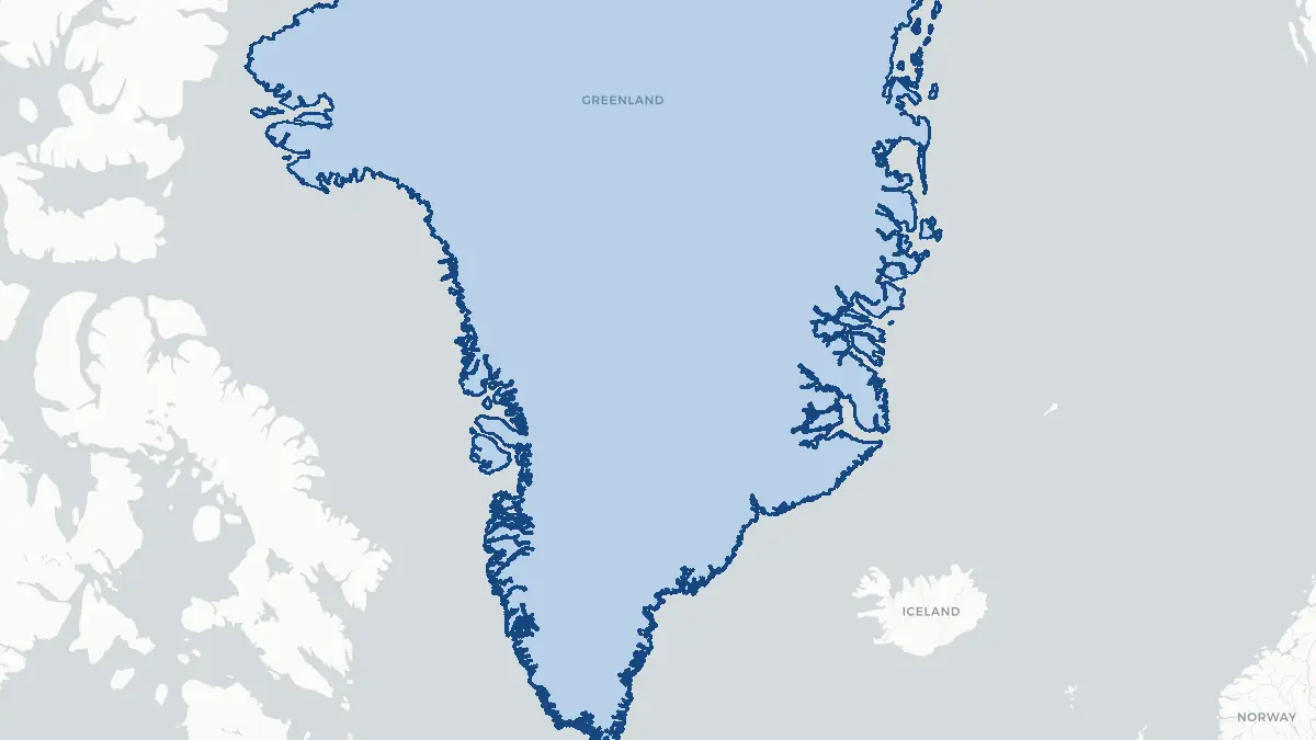
Greenland on the map
#### About Greenland Greenland is the world's largest island, situated between the Arctic and Atlantic oceans and forming an autonomous territory within the Kingdom of Denmark. Despite its vast size of over 2.1 million square kilometres, Greenland has a population of only around 56,000 people, making it one of the least densely populated territories on Earth. The capital, Nuuk, is home to roughly a third of the total population. The majority of inhabitants are Greenlandic Inuit, and the Greenlandic language, Kalaallisut, holds co-official status alongside Danish. Greenland has its own parliament, the Inatsisartut, and government, and exercises considerable self-governance, though Denmark retains responsibility for foreign affairs and defence. Discussions around full independence have grown increasingly prominent in recent years.
#### Geography and Landscape Approximately 80 percent of Greenland is permanently covered by the Greenland Ice Sheet, the second largest body of ice on Earth after the Antarctic Ice Sheet. The ice sheet reaches depths of up to three kilometres and contains enough frozen water to raise global sea levels by around seven metres if it were to melt entirely. The ice-free coastal fringe, particularly along the southwest, supports most of the human population and features dramatic fjords, tundra, and Arctic flora. The northeastern interior is protected as the Northeast Greenland National Park, the world's largest national park. Greenland's coastline is deeply indented with fjord systems of extraordinary scale, including the Ilulissat Icefjord, a UNESCO World Heritage Site.
#### History Greenland has been inhabited for at least 4,500 years by successive waves of Arctic peoples, including the Saqqaq and Dorset cultures. The ancestors of the modern Inuit, the Thule people, arrived around 1000 CE and gradually displaced earlier inhabitants. Norse settlers led by Erik the Red established colonies on the southwestern coast around 985 CE, which survived for several centuries before disappearing, likely due to climate cooling and resource pressure. Danish-Norwegian contact was re-established in the eighteenth century, and Greenland became a Danish colony in 1814. It was incorporated as a Danish county in 1953 and achieved home rule in 1979. The Greenlandic self-government act of 2009 significantly expanded autonomy and recognised Greenlanders as a distinct people under international law.
Geo Quiz
Think you know your capitals, flags, and continents? Take the quiz!
Neighbouring countries
Continue to nearby countries
There are no registered neighbouring countries for Greenland in the current database.
More countries in the same part of the world
North America index
Open the continent hub for North America to see the full country list, capitals and frequently asked questions on one page.
Interactive map
Zoomable map of Greenland
Country index
All countries by continent
Jump directly to the right section or keep scrolling.
Africa
58 countries- Algeria
- Angola
- Benin
- Botswana
- Burkina Faso
- Burundi
- Central African Republic
- Djibouti
- Democratic Republic of the Congo
- Egypt
- Equatorial Guinea
- Ivory Coast
- Eritrea
- Ethiopia
- Gabon
- Gambia
- Ghana
- Guinea
- Guinea-Bissau
- Cameroon
- Cape Verde
- Kenya
- Comoros
- Republic of the Congo
- Lesotho
- Liberia
- Libya
- Madagascar
- Malawi
- Mali
- Morocco
- Mauritania
- Mauritius
- Mayotte
- Mozambique
- Namibia
- Niger
- Nigeria
- Reunion
- Rwanda
- Saint Helena
- Sao Tome and Principe
- Senegal
- Seychelles
- Sierra Leone
- Somalia
- Sudan
- Swaziland
- South Africa
- South Sudan
- Tanzania
- Chad
- Togo
- Tunisia
- Uganda
- Western Sahara
- Zambia
- Zimbabwe
Asia
52 countries- Afghanistan
- Armenia
- Azerbaijan
- Bahrain
- Bangladesh
- Bhutan
- British Indian Ocean Territory
- Brunei
- Myanmar
- Philippines
- United Arab Emirates
- Georgia
- Hong Kong
- India
- Indonesia
- Iraq
- Iran
- Israel
- Japan
- Yemen
- Jordan
- Christmas Island
- Cambodia
- Kazakhstan
- China
- Kyrgyzstan
- Cocos Islands
- Kuwait
- Laos
- Lebanon
- Macau
- Malaysia
- Maldives
- Mongolia
- Nepal
- North Korea
- Oman
- Pakistan
- Palestinian Territory
- Qatar
- Saudi Arabia
- Singapore
- Sri Lanka
- South Korea
- Syria
- Tajikistan
- Taiwan
- Thailand
- Turkey
- Turkmenistan
- Uzbekistan
- Vietnam
Europe
53 countries- Albania
- Andorra
- Belgium
- Bosnia and Herzegovina
- Bulgaria
- Cyprus
- Denmark
- Estonia
- Finland
- France
- Faroe Islands
- Gibraltar
- Greece
- Guernsey
- Ireland
- Iceland
- Isle of Man
- Italy
- Jersey
- Kosovo
- Croatia
- Latvia
- Liechtenstein
- Lithuania
- Luxembourg
- Macedonia
- Malta
- Moldova
- Monaco
- Montenegro
- Netherlands
- Norway
- Poland
- Portugal
- Romania
- Russia
- San Marino
- Switzerland
- Serbia
- Slovakia
- Slovenia
- Spain
- United Kingdom
- Svalbard and Jan Mayen
- Sweden
- Czech Republic
- Germany
- Ukraine
- Hungary
- Vatican
- Belarus
- Aland Islands
- Austria
North America
42 countries- U.S. Virgin Islands
- Anguilla
- Antigua and Barbuda
- Aruba
- Bahamas
- Barbados
- Belize
- Bermuda
- Bonaire, Saint Eustatius and Saba
- British Virgin Islands
- Cayman Islands
- Costa Rica
- Curacao
- Dominica
- Dominican Republic
- El Salvador
- Grenada
- Greenland
- Guadeloupe
- Guatemala
- Haiti
- Honduras
- Jamaica
- Canada
- Cuba
- Martinique
- Mexico
- Montserrat
- Netherlands Antilles
- Nicaragua
- Panama
- Puerto Rico
- Saint Barthelemy
- Saint Kitts and Nevis
- Saint Lucia
- Saint Martin
- Saint Vincent and the Grenadines
- Saint Pierre and Miquelon
- Sint Maarten
- Trinidad and Tobago
- Turks and Caicos Islands
- United States
South America
14 countriesOceania
27 countries- American Samoa
- Australia
- Cook Islands
- Fiji
- French Polynesia
- United States Minor Outlying Islands
- Guam
- Kiribati
- Marshall Islands
- Micronesia
- Nauru
- Niue
- Northern Mariana Islands
- Norfolk Island
- New Caledonia
- New Zealand
- Palau
- Papua New Guinea
- Pitcairn
- Solomon Islands
- Samoa
- Tokelau
- Tonga
- Tuvalu
- Vanuatu
- Wallis and Futuna
- East Timor