
North America
Martinique — map and facts
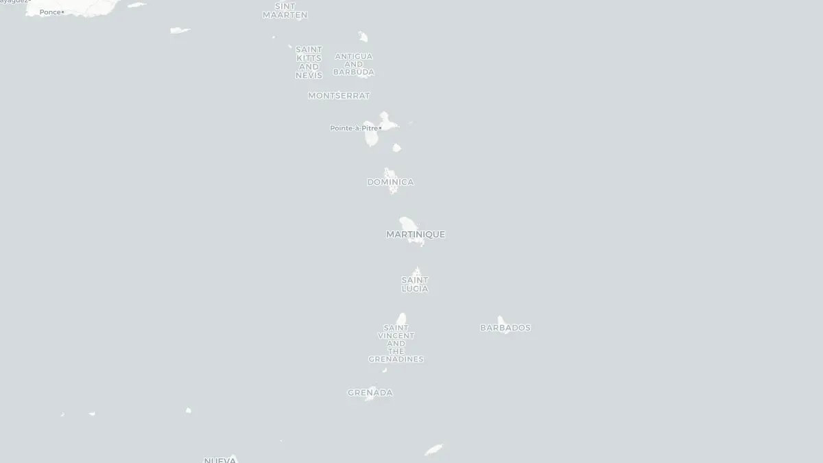
Here you find a map of Martinique, capital Fort-de-France, currency Euro and quick links to more facts about the country in North America.
About the country
Martinique on the map
About Martinique
Martinique is an island in the Lesser Antilles of the eastern Caribbean Sea and is an integral part of France, constituting both an overseas region and an overseas department. Fort-de-France is the capital and largest city, with the island's total population numbering approximately 350,000. As a full part of France, Martinique is also a region of the European Union, and residents hold French citizenship with full voting rights in French national elections. The official currency is the euro. The island's economy rests primarily on tourism, agriculture — particularly bananas and sugar cane — and transfers from the French state. Rum production, drawing on the island's long sugar-cane heritage, remains an important and internationally recognised industry, with Martinique's rhum agricole holding a protected designation of origin. Martinique has a rich cultural identity shaped by African, French, and Caribbean influences, and the Creole language is widely spoken alongside French.
Geography and Landscape
Martinique covers approximately 1,128 square kilometres in the eastern Caribbean, lying between Dominica to the north and Saint Lucia to the south. The island is of volcanic origin and is dominated by rugged, mountainous terrain in the north, becoming more rolling and hilly toward the south. Mont Pelée, in the north, is an active stratovolcano rising to 1,397 metres and is the island's highest point. The southern portion of the island has gentler topography, with savannahs, salt flats, and more accessible beaches. The coastline varies significantly, with sheltered bays and white sand beaches on the Caribbean (western) side and more exposed Atlantic coastline to the east, with rougher surf. Rainforests cover portions of the interior mountains, nourished by high rainfall. The climate is tropical, warm and humid year-round, with a dry season from January to June and a wetter season from July to December. The island lies within the Atlantic hurricane belt.
History
Martinique was home to Arawak and Carib peoples before European arrival. Christopher Columbus made landfall on the island in 1502. French colonisation began in earnest in 1635 when a French settlement was established. The island quickly became a significant sugar-producing colony, relying heavily on enslaved African labour. By the eighteenth century Martinique was among the most valuable French colonial possessions. The island briefly came under British control during the Napoleonic Wars before being restored to France. Slavery was abolished in French territories in 1848 following campaigns by Martinican-born abolitionist Victor Schoelcher. In 1902 the catastrophic eruption of Mont Pelée destroyed the city of Saint-Pierre and killed approximately 30,000 people, one of the deadliest volcanic disasters in recorded history. Martinique became a French overseas department in 1946, bringing it fully within the French Republic. In 2010 it was granted the additional status of an overseas region.
Geo Quiz
Think you know your capitals, flags, and continents? Take the quiz!
Neighbouring countries
Continue to nearby countries
There are no registered neighbouring countries for Martinique in the current database.
More countries in the same part of the world
North America index
Open the continent hub for North America to see the full country list, capitals and frequently asked questions on one page.
Interactive map
Zoomable map of Martinique
Country index
All countries by continent
Jump directly to the right section or keep scrolling.
Africa
58 countries- Algeria
- Angola
- Benin
- Botswana
- Burkina Faso
- Burundi
- Central African Republic
- Djibouti
- Democratic Republic of the Congo
- Egypt
- Equatorial Guinea
- Ivory Coast
- Eritrea
- Ethiopia
- Gabon
- Gambia
- Ghana
- Guinea
- Guinea-Bissau
- Cameroon
- Cape Verde
- Kenya
- Comoros
- Republic of the Congo
- Lesotho
- Liberia
- Libya
- Madagascar
- Malawi
- Mali
- Morocco
- Mauritania
- Mauritius
- Mayotte
- Mozambique
- Namibia
- Niger
- Nigeria
- Reunion
- Rwanda
- Saint Helena
- Sao Tome and Principe
- Senegal
- Seychelles
- Sierra Leone
- Somalia
- Sudan
- Swaziland
- South Africa
- South Sudan
- Tanzania
- Chad
- Togo
- Tunisia
- Uganda
- Western Sahara
- Zambia
- Zimbabwe
Asia
52 countries- Afghanistan
- Armenia
- Azerbaijan
- Bahrain
- Bangladesh
- Bhutan
- British Indian Ocean Territory
- Brunei
- Myanmar
- Philippines
- United Arab Emirates
- Georgia
- Hong Kong
- India
- Indonesia
- Iraq
- Iran
- Israel
- Japan
- Yemen
- Jordan
- Christmas Island
- Cambodia
- Kazakhstan
- China
- Kyrgyzstan
- Cocos Islands
- Kuwait
- Laos
- Lebanon
- Macau
- Malaysia
- Maldives
- Mongolia
- Nepal
- North Korea
- Oman
- Pakistan
- Palestinian Territory
- Qatar
- Saudi Arabia
- Singapore
- Sri Lanka
- South Korea
- Syria
- Tajikistan
- Taiwan
- Thailand
- Turkey
- Turkmenistan
- Uzbekistan
- Vietnam
Europe
53 countries- Albania
- Andorra
- Belgium
- Bosnia and Herzegovina
- Bulgaria
- Cyprus
- Denmark
- Estonia
- Finland
- France
- Faroe Islands
- Gibraltar
- Greece
- Guernsey
- Ireland
- Iceland
- Isle of Man
- Italy
- Jersey
- Kosovo
- Croatia
- Latvia
- Liechtenstein
- Lithuania
- Luxembourg
- Macedonia
- Malta
- Moldova
- Monaco
- Montenegro
- Netherlands
- Norway
- Poland
- Portugal
- Romania
- Russia
- San Marino
- Switzerland
- Serbia
- Slovakia
- Slovenia
- Spain
- United Kingdom
- Svalbard and Jan Mayen
- Sweden
- Czech Republic
- Germany
- Ukraine
- Hungary
- Vatican
- Belarus
- Aland Islands
- Austria
North America
42 countries- U.S. Virgin Islands
- Anguilla
- Antigua and Barbuda
- Aruba
- Bahamas
- Barbados
- Belize
- Bermuda
- Bonaire, Saint Eustatius and Saba
- British Virgin Islands
- Cayman Islands
- Costa Rica
- Curacao
- Dominica
- Dominican Republic
- El Salvador
- Grenada
- Greenland
- Guadeloupe
- Guatemala
- Haiti
- Honduras
- Jamaica
- Canada
- Cuba
- Martinique
- Mexico
- Montserrat
- Netherlands Antilles
- Nicaragua
- Panama
- Puerto Rico
- Saint Barthelemy
- Saint Kitts and Nevis
- Saint Lucia
- Saint Martin
- Saint Vincent and the Grenadines
- Saint Pierre and Miquelon
- Sint Maarten
- Trinidad and Tobago
- Turks and Caicos Islands
- United States
South America
14 countriesOceania
27 countries- American Samoa
- Australia
- Cook Islands
- Fiji
- French Polynesia
- United States Minor Outlying Islands
- Guam
- Kiribati
- Marshall Islands
- Micronesia
- Nauru
- Niue
- Northern Mariana Islands
- Norfolk Island
- New Caledonia
- New Zealand
- Palau
- Papua New Guinea
- Pitcairn
- Solomon Islands
- Samoa
- Tokelau
- Tonga
- Tuvalu
- Vanuatu
- Wallis and Futuna
- East Timor