
North America
Saint Martin — map and facts
Here you find a map of Saint Martin, capital Marigot, currency Euro and quick links to more facts about the country in North America.
About the country
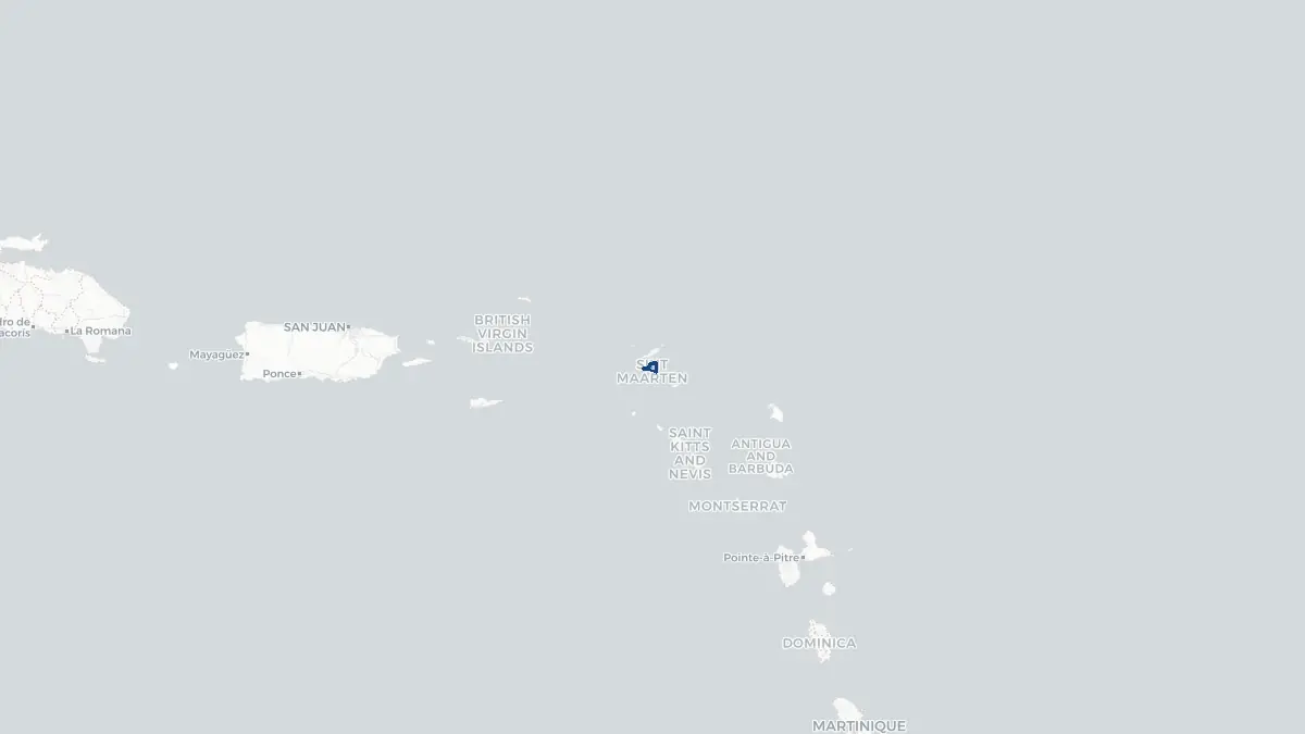
Saint Martin on the map
About Saint Martin French part
Saint Martin is a French overseas collectivity occupying the northern part of the island of Saint Martin in the northeastern Caribbean Sea. The southern portion of the island is the Dutch territory of Sint Maarten. Marigot serves as the capital of the French part, which has a population of approximately 32,000. Saint Martin became a French overseas collectivity in 2007, when it was separated from Guadeloupe and granted its own territorial council. As an overseas collectivity, it has greater autonomy than a standard French overseas department but remains formally part of France. Residents are French citizens and the euro is the official currency. The economy is heavily dependent on tourism, with the island attracting visitors with its beaches, duty-free shopping, and diverse restaurant culture. The island is known for its relaxed atmosphere and the remarkable peaceful coexistence of French and Dutch administrations, a border arrangement dating to the 1648 Treaty of Concordia.
Geography and Landscape
Saint Martin covers approximately 53 square kilometres on the northern portion of a shared island in the Leeward Islands group of the Lesser Antilles. The island as a whole is roughly 87 square kilometres. The terrain is hilly, with the highest point on the French side reaching around 424 metres at Pic Paradis, which offers panoramic views over both sides of the island and surrounding seas. The coastline alternates between rocky headlands and sheltered sandy bays, including the well-known Baie Orientale (Orient Bay) and Baie de Friar. The island has several saltwater ponds and lagoons, the largest being the Simpson Bay Lagoon, which straddles the border with Sint Maarten. Vegetation is tropical, with dry scrub on exposed hillsides and more lush growth in sheltered valleys. The climate is warm and tropical year-round, with a relatively dry season from December to April and a wetter, more humid period from June to November. The island sits within the Atlantic hurricane belt.
History
The island of Saint Martin was inhabited by Arawak and later Carib peoples before European contact. Christopher Columbus sighted the island in 1493 and named it after Saint Martin of Tours. The Dutch and French began competing for control in the seventeenth century, and in 1648 they concluded the Treaty of Concordia, dividing the island between them in what became one of the world's smallest land borders between two nations. The French side was administered as part of Guadeloupe for centuries. The island's economy historically relied on salt production and agriculture, including sugar cultivation using enslaved labour. Following the abolition of slavery in French territories in 1848, the economy gradually shifted. Tourism became the dominant industry in the latter twentieth century. In 2007, Saint Martin became a separate French overseas collectivity. Hurricane Irma caused catastrophic damage to the island in September 2017, requiring extensive reconstruction efforts that continued for several years.
Geo Quiz
Think you know your capitals, flags, and continents? Take the quiz!
Neighbouring countries
Continue to nearby countries
More countries in the same part of the world
North America index
Open the continent hub for North America to see the full country list, capitals and frequently asked questions on one page.
Interactive map
Zoomable map of Saint Martin
Country index
All countries by continent
Jump directly to the right section or keep scrolling.
Africa
58 countries- Algeria
- Angola
- Benin
- Botswana
- Burkina Faso
- Burundi
- Central African Republic
- Djibouti
- Democratic Republic of the Congo
- Egypt
- Equatorial Guinea
- Ivory Coast
- Eritrea
- Ethiopia
- Gabon
- Gambia
- Ghana
- Guinea
- Guinea-Bissau
- Cameroon
- Cape Verde
- Kenya
- Comoros
- Republic of the Congo
- Lesotho
- Liberia
- Libya
- Madagascar
- Malawi
- Mali
- Morocco
- Mauritania
- Mauritius
- Mayotte
- Mozambique
- Namibia
- Niger
- Nigeria
- Reunion
- Rwanda
- Saint Helena
- Sao Tome and Principe
- Senegal
- Seychelles
- Sierra Leone
- Somalia
- Sudan
- Swaziland
- South Africa
- South Sudan
- Tanzania
- Chad
- Togo
- Tunisia
- Uganda
- Western Sahara
- Zambia
- Zimbabwe
Asia
52 countries- Afghanistan
- Armenia
- Azerbaijan
- Bahrain
- Bangladesh
- Bhutan
- British Indian Ocean Territory
- Brunei
- Myanmar
- Philippines
- United Arab Emirates
- Georgia
- Hong Kong
- India
- Indonesia
- Iraq
- Iran
- Israel
- Japan
- Yemen
- Jordan
- Christmas Island
- Cambodia
- Kazakhstan
- China
- Kyrgyzstan
- Cocos Islands
- Kuwait
- Laos
- Lebanon
- Macau
- Malaysia
- Maldives
- Mongolia
- Nepal
- North Korea
- Oman
- Pakistan
- Palestinian Territory
- Qatar
- Saudi Arabia
- Singapore
- Sri Lanka
- South Korea
- Syria
- Tajikistan
- Taiwan
- Thailand
- Turkey
- Turkmenistan
- Uzbekistan
- Vietnam
Europe
53 countries- Albania
- Andorra
- Belgium
- Bosnia and Herzegovina
- Bulgaria
- Cyprus
- Denmark
- Estonia
- Finland
- France
- Faroe Islands
- Gibraltar
- Greece
- Guernsey
- Ireland
- Iceland
- Isle of Man
- Italy
- Jersey
- Kosovo
- Croatia
- Latvia
- Liechtenstein
- Lithuania
- Luxembourg
- Macedonia
- Malta
- Moldova
- Monaco
- Montenegro
- Netherlands
- Norway
- Poland
- Portugal
- Romania
- Russia
- San Marino
- Switzerland
- Serbia
- Slovakia
- Slovenia
- Spain
- United Kingdom
- Svalbard and Jan Mayen
- Sweden
- Czech Republic
- Germany
- Ukraine
- Hungary
- Vatican
- Belarus
- Aland Islands
- Austria
North America
42 countries- U.S. Virgin Islands
- Anguilla
- Antigua and Barbuda
- Aruba
- Bahamas
- Barbados
- Belize
- Bermuda
- Bonaire, Saint Eustatius and Saba
- British Virgin Islands
- Cayman Islands
- Costa Rica
- Curacao
- Dominica
- Dominican Republic
- El Salvador
- Grenada
- Greenland
- Guadeloupe
- Guatemala
- Haiti
- Honduras
- Jamaica
- Canada
- Cuba
- Martinique
- Mexico
- Montserrat
- Netherlands Antilles
- Nicaragua
- Panama
- Puerto Rico
- Saint Barthelemy
- Saint Kitts and Nevis
- Saint Lucia
- Saint Martin
- Saint Vincent and the Grenadines
- Saint Pierre and Miquelon
- Sint Maarten
- Trinidad and Tobago
- Turks and Caicos Islands
- United States
South America
14 countriesOceania
27 countries- American Samoa
- Australia
- Cook Islands
- Fiji
- French Polynesia
- United States Minor Outlying Islands
- Guam
- Kiribati
- Marshall Islands
- Micronesia
- Nauru
- Niue
- Northern Mariana Islands
- Norfolk Island
- New Caledonia
- New Zealand
- Palau
- Papua New Guinea
- Pitcairn
- Solomon Islands
- Samoa
- Tokelau
- Tonga
- Tuvalu
- Vanuatu
- Wallis and Futuna
- East Timor