
North America
Nicaragua — map and facts
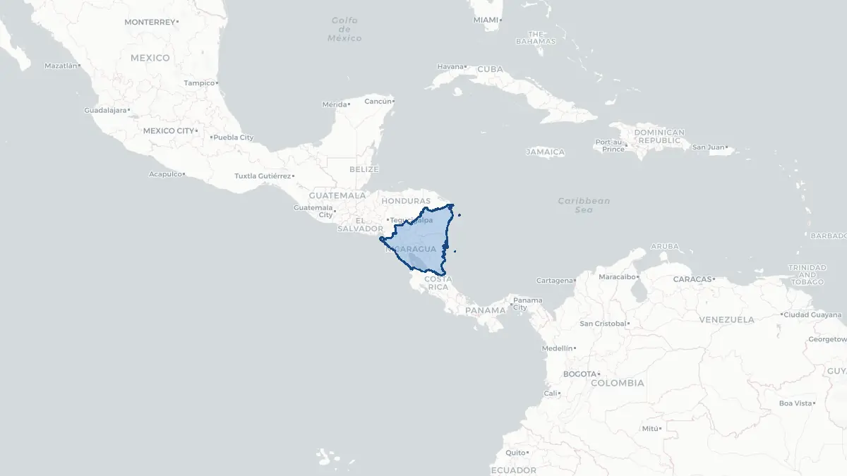
Here you find a map of Nicaragua, capital Managua, currency Cordoba and quick links to more facts about the country in North America.
About the country
Nicaragua on the map
About Nicaragua
Nicaragua is the largest country in Central America, situated between Honduras to the north and Costa Rica to the south, with coastlines on both the Pacific Ocean and the Caribbean Sea. Its capital and largest city is Managua. The country has a population of approximately 6.8 million people, though emigration has increased sharply in recent years due to political repression. Nicaragua is a republic, currently governed under the authoritarian rule of President Daniel Ortega, who returned to power in 2007 after earlier leading the country following the 1979 Sandinista revolution. The official language is Spanish, and the country has a significant mestizo majority alongside indigenous, Afro-Caribbean, and European-descended communities. Nicaragua is one of the poorest countries in the Western Hemisphere. Its economy is based on agriculture, including the export of coffee, beef, gold, sugar, and peanuts, alongside remittances which have become increasingly important as emigration has accelerated.
Geography and Landscape
Nicaragua's geography is characterised by striking contrasts. The Pacific coast lowlands in the west are dominated by a chain of volcanoes, including Momotombo and the active Masaya volcano, which has a permanently open lava lake. Lake Managua and Lake Nicaragua, the latter being the largest lake in Central America, occupy the Pacific lowland region. The central highlands rise to over 2,000 metres and are covered in cloud forest and coffee plantations. In contrast, the eastern Caribbean coast, known as the Mosquito Coast or Costa Caribe, is a vast, sparsely populated lowland of tropical rainforest, wetlands, rivers, and lagoons, with a distinct indigenous and Afro-Caribbean culture. This region receives some of the highest rainfall in the Western Hemisphere. Nicaragua sits in an active seismic and volcanic zone, making it vulnerable to earthquakes, volcanic eruptions, and, along its Caribbean coast, to Atlantic hurricanes. The 1972 Managua earthquake caused catastrophic destruction.
History
Nicaragua's pre-Columbian history includes numerous indigenous groups, including the Nicarao people after whom the country is named. Spanish conquistadors arrived in the early 16th century, and the territory was colonised as part of the Captaincy General of Guatemala. Independence was achieved in 1821 as part of the Central American Federation, and Nicaragua became a fully independent republic in 1838. The 19th and early 20th centuries were marked by repeated US military interventions and the occupation of 1912–1933, resisted by the nationalist guerrilla leader Augusto César Sandino. The Somoza family dictatorship dominated the country from 1936 until the Sandinista Revolution of 1979, led by the FSLN. The 1980s were defined by the US-backed Contra war against the Sandinista government and a devastating civil conflict. Following peace agreements and elections in 1990, Nicaragua began a democratic transition, but the return of Daniel Ortega and his increasingly repressive rule from 2007 onward has led to a severe political and humanitarian crisis, with mass emigration accelerating after the violent crackdown on protests in 2018.
Geo Quiz
Think you know your capitals, flags, and continents? Take the quiz!
Neighbouring countries
Continue to nearby countries
More countries in the same part of the world
North America index
Open the continent hub for North America to see the full country list, capitals and frequently asked questions on one page.
Interactive map
Zoomable map of Nicaragua
Country index
All countries by continent
Jump directly to the right section or keep scrolling.
Africa
58 countries- Algeria
- Angola
- Benin
- Botswana
- Burkina Faso
- Burundi
- Central African Republic
- Djibouti
- Democratic Republic of the Congo
- Egypt
- Equatorial Guinea
- Ivory Coast
- Eritrea
- Ethiopia
- Gabon
- Gambia
- Ghana
- Guinea
- Guinea-Bissau
- Cameroon
- Cape Verde
- Kenya
- Comoros
- Republic of the Congo
- Lesotho
- Liberia
- Libya
- Madagascar
- Malawi
- Mali
- Morocco
- Mauritania
- Mauritius
- Mayotte
- Mozambique
- Namibia
- Niger
- Nigeria
- Reunion
- Rwanda
- Saint Helena
- Sao Tome and Principe
- Senegal
- Seychelles
- Sierra Leone
- Somalia
- Sudan
- Swaziland
- South Africa
- South Sudan
- Tanzania
- Chad
- Togo
- Tunisia
- Uganda
- Western Sahara
- Zambia
- Zimbabwe
Asia
52 countries- Afghanistan
- Armenia
- Azerbaijan
- Bahrain
- Bangladesh
- Bhutan
- British Indian Ocean Territory
- Brunei
- Myanmar
- Philippines
- United Arab Emirates
- Georgia
- Hong Kong
- India
- Indonesia
- Iraq
- Iran
- Israel
- Japan
- Yemen
- Jordan
- Christmas Island
- Cambodia
- Kazakhstan
- China
- Kyrgyzstan
- Cocos Islands
- Kuwait
- Laos
- Lebanon
- Macau
- Malaysia
- Maldives
- Mongolia
- Nepal
- North Korea
- Oman
- Pakistan
- Palestinian Territory
- Qatar
- Saudi Arabia
- Singapore
- Sri Lanka
- South Korea
- Syria
- Tajikistan
- Taiwan
- Thailand
- Turkey
- Turkmenistan
- Uzbekistan
- Vietnam
Europe
53 countries- Albania
- Andorra
- Belgium
- Bosnia and Herzegovina
- Bulgaria
- Cyprus
- Denmark
- Estonia
- Finland
- France
- Faroe Islands
- Gibraltar
- Greece
- Guernsey
- Ireland
- Iceland
- Isle of Man
- Italy
- Jersey
- Kosovo
- Croatia
- Latvia
- Liechtenstein
- Lithuania
- Luxembourg
- Macedonia
- Malta
- Moldova
- Monaco
- Montenegro
- Netherlands
- Norway
- Poland
- Portugal
- Romania
- Russia
- San Marino
- Switzerland
- Serbia
- Slovakia
- Slovenia
- Spain
- United Kingdom
- Svalbard and Jan Mayen
- Sweden
- Czech Republic
- Germany
- Ukraine
- Hungary
- Vatican
- Belarus
- Aland Islands
- Austria
North America
42 countries- U.S. Virgin Islands
- Anguilla
- Antigua and Barbuda
- Aruba
- Bahamas
- Barbados
- Belize
- Bermuda
- Bonaire, Saint Eustatius and Saba
- British Virgin Islands
- Cayman Islands
- Costa Rica
- Curacao
- Dominica
- Dominican Republic
- El Salvador
- Grenada
- Greenland
- Guadeloupe
- Guatemala
- Haiti
- Honduras
- Jamaica
- Canada
- Cuba
- Martinique
- Mexico
- Montserrat
- Netherlands Antilles
- Nicaragua
- Panama
- Puerto Rico
- Saint Barthelemy
- Saint Kitts and Nevis
- Saint Lucia
- Saint Martin
- Saint Vincent and the Grenadines
- Saint Pierre and Miquelon
- Sint Maarten
- Trinidad and Tobago
- Turks and Caicos Islands
- United States
South America
14 countriesOceania
27 countries- American Samoa
- Australia
- Cook Islands
- Fiji
- French Polynesia
- United States Minor Outlying Islands
- Guam
- Kiribati
- Marshall Islands
- Micronesia
- Nauru
- Niue
- Northern Mariana Islands
- Norfolk Island
- New Caledonia
- New Zealand
- Palau
- Papua New Guinea
- Pitcairn
- Solomon Islands
- Samoa
- Tokelau
- Tonga
- Tuvalu
- Vanuatu
- Wallis and Futuna
- East Timor