
North America
Curacao — map and facts
Here you find a map of Curacao, capital Willemstad, currency Antiller gulden and quick links to more facts about the country in North America.
About the country
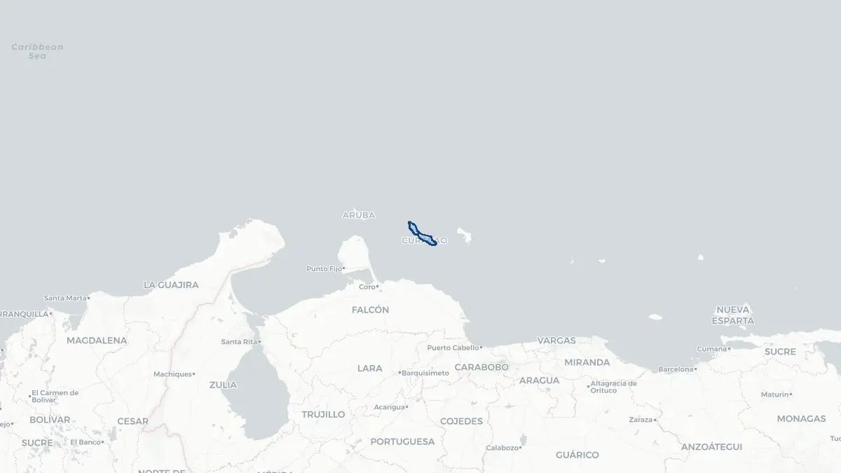
Curacao on the map
About Curaçao
Curaçao is a constituent country of the Kingdom of the Netherlands, situated in the southern Caribbean Sea approximately 65 kilometres north of the Venezuelan coast. It is the largest of the ABC islands and has a population of around 150,000 people. The capital and largest city is Willemstad, whose historic inner harbour, bounded by the colourful Dutch colonial architecture of the Punda and Otrobanda districts, is a UNESCO World Heritage Site. Curaçao became a separate country within the Kingdom on 10 October 2010, when the Netherlands Antilles was dissolved. The official languages are Papiamentu, Dutch, and English. The economy is based primarily on tourism, oil refining at the large Isla refinery, offshore financial services, and ship repair. The island uses the Netherlands Antillean guilder alongside the US dollar in practice. Curaçao is known for its vibrant Afro-Caribbean culture, diverse population, and the liqueur Curaçao, made from the dried peel of the laraha citrus fruit.
Geography and Landscape
Curaçao covers approximately 444 square kilometres and has a varied terrain of low hills, coastal cliffs, and sheltered bays. The island is arid, lying outside the main hurricane belt and receiving around 550 millimetres of rainfall annually. The northeastern coast is rugged and windswept, while the southwestern coast features calm, clear bays ideal for swimming and diving. The highest point is the Sint Christoffelberg at 372 metres, located within Christoffelpark, which also protects dry tropical forest, cacti, and scrubland. The island's limestone geology creates cave systems, most famously the Hato Caves. Coral reefs fringe much of the coastline, and the waters around Curaçao are renowned for their clarity and marine biodiversity. Mangrove lagoons, salt pans, and brackish pools provide habitats for migratory birds and flamingos. The divi-divi tree and various cacti species define the distinctive arid interior landscape.
History
Before European contact, Curaçao was inhabited by the Caquetio people, an Arawakan group. Spanish explorers reached the island in 1499, and the Spanish established a settlement, expelling or enslaving the indigenous population. The Dutch West India Company captured Curaçao in 1634 and developed it into a major entrepôt and slave-trading centre. Willemstad became one of the busiest ports in the Atlantic world during the seventeenth and eighteenth centuries, facilitating trade between Europe, Africa, and the Americas. The slave trade brought a large African population whose descendants form the core of Curaçao's modern culture. After emancipation in 1863, the island's economy shifted toward refining and trade. When oil was discovered in Venezuela in the early twentieth century, Royal Dutch Shell built a major refinery in Curaçao in 1918, which operated for decades. The island was part of the Netherlands Antilles from 1954 until 2010, when it became a separate autonomous country within the Kingdom of the Netherlands.
Geo Quiz
Think you know your capitals, flags, and continents? Take the quiz!
Neighbouring countries
Continue to nearby countries
There are no registered neighbouring countries for Curacao in the current database.
More countries in the same part of the world
North America index
Open the continent hub for North America to see the full country list, capitals and frequently asked questions on one page.
Interactive map
Zoomable map of Curacao
Country index
All countries by continent
Jump directly to the right section or keep scrolling.
Africa
58 countries- Algeria
- Angola
- Benin
- Botswana
- Burkina Faso
- Burundi
- Central African Republic
- Djibouti
- Democratic Republic of the Congo
- Egypt
- Equatorial Guinea
- Ivory Coast
- Eritrea
- Ethiopia
- Gabon
- Gambia
- Ghana
- Guinea
- Guinea-Bissau
- Cameroon
- Cape Verde
- Kenya
- Comoros
- Republic of the Congo
- Lesotho
- Liberia
- Libya
- Madagascar
- Malawi
- Mali
- Morocco
- Mauritania
- Mauritius
- Mayotte
- Mozambique
- Namibia
- Niger
- Nigeria
- Reunion
- Rwanda
- Saint Helena
- Sao Tome and Principe
- Senegal
- Seychelles
- Sierra Leone
- Somalia
- Sudan
- Swaziland
- South Africa
- South Sudan
- Tanzania
- Chad
- Togo
- Tunisia
- Uganda
- Western Sahara
- Zambia
- Zimbabwe
Asia
52 countries- Afghanistan
- Armenia
- Azerbaijan
- Bahrain
- Bangladesh
- Bhutan
- British Indian Ocean Territory
- Brunei
- Myanmar
- Philippines
- United Arab Emirates
- Georgia
- Hong Kong
- India
- Indonesia
- Iraq
- Iran
- Israel
- Japan
- Yemen
- Jordan
- Christmas Island
- Cambodia
- Kazakhstan
- China
- Kyrgyzstan
- Cocos Islands
- Kuwait
- Laos
- Lebanon
- Macau
- Malaysia
- Maldives
- Mongolia
- Nepal
- North Korea
- Oman
- Pakistan
- Palestinian Territory
- Qatar
- Saudi Arabia
- Singapore
- Sri Lanka
- South Korea
- Syria
- Tajikistan
- Taiwan
- Thailand
- Turkey
- Turkmenistan
- Uzbekistan
- Vietnam
Europe
53 countries- Albania
- Andorra
- Belgium
- Bosnia and Herzegovina
- Bulgaria
- Cyprus
- Denmark
- Estonia
- Finland
- France
- Faroe Islands
- Gibraltar
- Greece
- Guernsey
- Ireland
- Iceland
- Isle of Man
- Italy
- Jersey
- Kosovo
- Croatia
- Latvia
- Liechtenstein
- Lithuania
- Luxembourg
- Macedonia
- Malta
- Moldova
- Monaco
- Montenegro
- Netherlands
- Norway
- Poland
- Portugal
- Romania
- Russia
- San Marino
- Switzerland
- Serbia
- Slovakia
- Slovenia
- Spain
- United Kingdom
- Svalbard and Jan Mayen
- Sweden
- Czech Republic
- Germany
- Ukraine
- Hungary
- Vatican
- Belarus
- Aland Islands
- Austria
North America
42 countries- U.S. Virgin Islands
- Anguilla
- Antigua and Barbuda
- Aruba
- Bahamas
- Barbados
- Belize
- Bermuda
- Bonaire, Saint Eustatius and Saba
- British Virgin Islands
- Cayman Islands
- Costa Rica
- Curacao
- Dominica
- Dominican Republic
- El Salvador
- Grenada
- Greenland
- Guadeloupe
- Guatemala
- Haiti
- Honduras
- Jamaica
- Canada
- Cuba
- Martinique
- Mexico
- Montserrat
- Netherlands Antilles
- Nicaragua
- Panama
- Puerto Rico
- Saint Barthelemy
- Saint Kitts and Nevis
- Saint Lucia
- Saint Martin
- Saint Vincent and the Grenadines
- Saint Pierre and Miquelon
- Sint Maarten
- Trinidad and Tobago
- Turks and Caicos Islands
- United States
South America
14 countriesOceania
27 countries- American Samoa
- Australia
- Cook Islands
- Fiji
- French Polynesia
- United States Minor Outlying Islands
- Guam
- Kiribati
- Marshall Islands
- Micronesia
- Nauru
- Niue
- Northern Mariana Islands
- Norfolk Island
- New Caledonia
- New Zealand
- Palau
- Papua New Guinea
- Pitcairn
- Solomon Islands
- Samoa
- Tokelau
- Tonga
- Tuvalu
- Vanuatu
- Wallis and Futuna
- East Timor