
Europe
Montenegro — map and facts
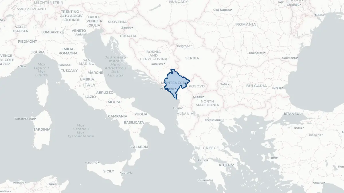
Here you find a map of Montenegro, capital Podgorica, currency Euro and quick links to more facts about the country in Europe.
About the country
Montenegro on the map
About Montenegro
Montenegro is a small Adriatic nation of approximately 620,000 people in the western Balkans, bordered by Bosnia and Herzegovina, Serbia, Kosovo, Albania, and Croatia. Its capital is Podgorica, while the historic coastal town of Cetinje was the former royal capital. Montenegro became a NATO member in 2017 and is an EU accession candidate. It declared independence from the State of Serbia and Montenegro in June 2006, following a referendum. The official language is Montenegrin, closely related to Serbian, Croatian, and Bosnian. The country's economy relies heavily on tourism — the Adriatic coast and Bay of Kotor attract significant numbers of visitors — as well as remittances and small-scale industry. Montenegro's name means "Black Mountain" in Italian, referring to the Lov?en massif that dominates its landscape.
Geography and Landscape
Montenegro is one of the most geographically diverse countries in Europe for its size. The Adriatic coast, though just 293 kilometres long, includes the spectacular Bay of Kotor (Boka Kotorska), a drowned river canyon often described as the southernmost fjord in Europe, and a string of resort beaches. The Dinaric Alps rise steeply from the coast to mountain ranges that include Durmitor (2,523 m), one of Europe's most impressive karst landscapes with glacial lakes, canyons, and the Tara River Canyon — Europe's deepest river canyon. The interior holds the historic Lake Skadar (Shkodër), the largest lake in the Balkans, shared with Albania. The climate ranges from Mediterranean on the coast to harsh alpine in the mountains, with some of the highest rainfall totals in Europe recorded in the northern highlands.
History
The region was part of Illyrian and Roman territories before Slavic tribes settled in the seventh century. The medieval principality of Zeta emerged in the area and resisted Ottoman conquest longer than most Balkan territories, with Cetinje remaining a mountain stronghold. Montenegro was recognised as an independent principality under the 1878 Treaty of Berlin and became a kingdom in 1910. It was occupied by Austria-Hungary during the First World War and incorporated into the Kingdom of Serbs, Croats, and Slovenes in 1918, later Yugoslavia. After Yugoslavia's collapse, Montenegro remained in a federation with Serbia. The 2006 independence referendum passed by a narrow margin. Montenegro joined NATO in 2017 and continues EU accession negotiations.
Geo Quiz
Think you know your capitals, flags, and continents? Take the quiz!
Neighbouring countries
Continue to nearby countries
More countries in the same part of the world
Europe index
Open the continent hub for Europe to see the full country list, capitals and frequently asked questions on one page.
Interactive map
Zoomable map of Montenegro
Country index
All countries by continent
Jump directly to the right section or keep scrolling.
Africa
58 countries- Algeria
- Angola
- Benin
- Botswana
- Burkina Faso
- Burundi
- Central African Republic
- Djibouti
- Democratic Republic of the Congo
- Egypt
- Equatorial Guinea
- Ivory Coast
- Eritrea
- Ethiopia
- Gabon
- Gambia
- Ghana
- Guinea
- Guinea-Bissau
- Cameroon
- Cape Verde
- Kenya
- Comoros
- Republic of the Congo
- Lesotho
- Liberia
- Libya
- Madagascar
- Malawi
- Mali
- Morocco
- Mauritania
- Mauritius
- Mayotte
- Mozambique
- Namibia
- Niger
- Nigeria
- Reunion
- Rwanda
- Saint Helena
- Sao Tome and Principe
- Senegal
- Seychelles
- Sierra Leone
- Somalia
- Sudan
- Swaziland
- South Africa
- South Sudan
- Tanzania
- Chad
- Togo
- Tunisia
- Uganda
- Western Sahara
- Zambia
- Zimbabwe
Asia
52 countries- Afghanistan
- Armenia
- Azerbaijan
- Bahrain
- Bangladesh
- Bhutan
- British Indian Ocean Territory
- Brunei
- Myanmar
- Philippines
- United Arab Emirates
- Georgia
- Hong Kong
- India
- Indonesia
- Iraq
- Iran
- Israel
- Japan
- Yemen
- Jordan
- Christmas Island
- Cambodia
- Kazakhstan
- China
- Kyrgyzstan
- Cocos Islands
- Kuwait
- Laos
- Lebanon
- Macau
- Malaysia
- Maldives
- Mongolia
- Nepal
- North Korea
- Oman
- Pakistan
- Palestinian Territory
- Qatar
- Saudi Arabia
- Singapore
- Sri Lanka
- South Korea
- Syria
- Tajikistan
- Taiwan
- Thailand
- Turkey
- Turkmenistan
- Uzbekistan
- Vietnam
Europe
53 countries- Albania
- Andorra
- Belgium
- Bosnia and Herzegovina
- Bulgaria
- Cyprus
- Denmark
- Estonia
- Finland
- France
- Faroe Islands
- Gibraltar
- Greece
- Guernsey
- Ireland
- Iceland
- Isle of Man
- Italy
- Jersey
- Kosovo
- Croatia
- Latvia
- Liechtenstein
- Lithuania
- Luxembourg
- Macedonia
- Malta
- Moldova
- Monaco
- Montenegro
- Netherlands
- Norway
- Poland
- Portugal
- Romania
- Russia
- San Marino
- Switzerland
- Serbia
- Slovakia
- Slovenia
- Spain
- United Kingdom
- Svalbard and Jan Mayen
- Sweden
- Czech Republic
- Germany
- Ukraine
- Hungary
- Vatican
- Belarus
- Aland Islands
- Austria
North America
42 countries- U.S. Virgin Islands
- Anguilla
- Antigua and Barbuda
- Aruba
- Bahamas
- Barbados
- Belize
- Bermuda
- Bonaire, Saint Eustatius and Saba
- British Virgin Islands
- Cayman Islands
- Costa Rica
- Curacao
- Dominica
- Dominican Republic
- El Salvador
- Grenada
- Greenland
- Guadeloupe
- Guatemala
- Haiti
- Honduras
- Jamaica
- Canada
- Cuba
- Martinique
- Mexico
- Montserrat
- Netherlands Antilles
- Nicaragua
- Panama
- Puerto Rico
- Saint Barthelemy
- Saint Kitts and Nevis
- Saint Lucia
- Saint Martin
- Saint Vincent and the Grenadines
- Saint Pierre and Miquelon
- Sint Maarten
- Trinidad and Tobago
- Turks and Caicos Islands
- United States
South America
14 countriesOceania
27 countries- American Samoa
- Australia
- Cook Islands
- Fiji
- French Polynesia
- United States Minor Outlying Islands
- Guam
- Kiribati
- Marshall Islands
- Micronesia
- Nauru
- Niue
- Northern Mariana Islands
- Norfolk Island
- New Caledonia
- New Zealand
- Palau
- Papua New Guinea
- Pitcairn
- Solomon Islands
- Samoa
- Tokelau
- Tonga
- Tuvalu
- Vanuatu
- Wallis and Futuna
- East Timor