
North America
Saint Pierre and Miquelon — map and facts
Here you find a map of Saint Pierre and Miquelon, capital Saint-Pierre, currency Euro and quick links to more facts about the country in North America.
About the country
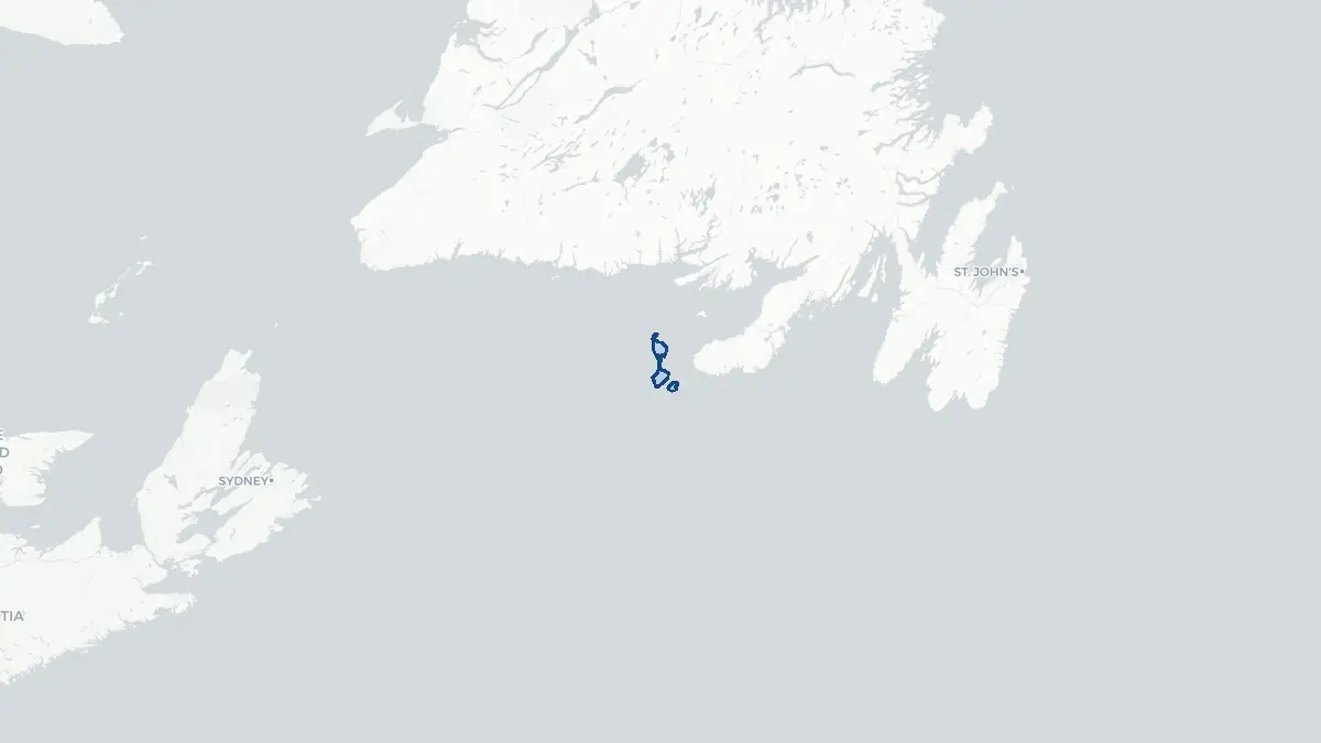
Saint Pierre and Miquelon on the map
About Saint Pierre and Miquelon
Saint Pierre and Miquelon is a French territorial collectivity located in the North Atlantic Ocean, just off the southern coast of Newfoundland, Canada. It is the only part of the former French empire in North America that remains under French sovereignty. The capital and main settlement is Saint-Pierre, located on the island of the same name. The total population is approximately 6,000 people, most of whom live on Saint-Pierre. As a French overseas collectivity, the territory sends elected representatives to the French National Assembly and Senate. Residents are French citizens with full rights. The local economy has historically relied on fishing, particularly cod, but the collapse of cod stocks in the early 1990s severely impacted livelihoods. Today the territory depends heavily on subsidies from France, along with limited tourism, aquaculture, and services. The territory uses the euro and French is the official language.
Geography and Landscape
Saint Pierre and Miquelon consists of several islands with a combined area of approximately 242 square kilometres. The two main islands are Saint-Pierre and Miquelon-Langlade. Saint-Pierre is the smaller but more densely populated island and serves as the administrative centre. Miquelon-Langlade is actually two islands connected by a narrow sandy isthmus called La Dune, forming a distinctive figure. The terrain of both islands is rugged, largely composed of rocky hills, moorland, and bog with thin acidic soils. There is little arable land. The coastline is irregular, with small coves, rocky headlands, and exposed beaches. The climate is cold and temperate, heavily influenced by the Labrador Current, which brings cold waters and frequent fog. Winters are long and harsh, summers short and cool. The islands receive considerable snowfall and are frequently affected by strong Atlantic winds.
History
Basque and Breton fishermen frequented these waters from the early sixteenth century, drawn by the rich cod fisheries of the Grand Banks. France formally claimed the islands in 1536, and they changed hands multiple times between France and Britain through various treaties over the following centuries, reflecting the broader contest for North American dominance. Britain finally ceded the islands permanently to France by the Treaty of Paris in 1814. During Prohibition in the United States in the 1920s and early 1930s, the islands became a significant transshipment point for alcohol destined for the American market, bringing brief economic prosperity. The cod fishing industry dominated the local economy for most of the twentieth century until the collapse of fish stocks led Canada to drastically reduce fishing quotas in 1992. The territory gained its current status as a French overseas collectivity in 2003, replacing its former status as a territorial collectivity under a slightly different constitutional arrangement.
Geo Quiz
Think you know your capitals, flags, and continents? Take the quiz!
Neighbouring countries
Continue to nearby countries
There are no registered neighbouring countries for Saint Pierre and Miquelon in the current database.
More countries in the same part of the world
North America index
Open the continent hub for North America to see the full country list, capitals and frequently asked questions on one page.
Interactive map
Zoomable map of Saint Pierre and Miquelon
Country index
All countries by continent
Jump directly to the right section or keep scrolling.
Africa
58 countries- Algeria
- Angola
- Benin
- Botswana
- Burkina Faso
- Burundi
- Central African Republic
- Djibouti
- Democratic Republic of the Congo
- Egypt
- Equatorial Guinea
- Ivory Coast
- Eritrea
- Ethiopia
- Gabon
- Gambia
- Ghana
- Guinea
- Guinea-Bissau
- Cameroon
- Cape Verde
- Kenya
- Comoros
- Republic of the Congo
- Lesotho
- Liberia
- Libya
- Madagascar
- Malawi
- Mali
- Morocco
- Mauritania
- Mauritius
- Mayotte
- Mozambique
- Namibia
- Niger
- Nigeria
- Reunion
- Rwanda
- Saint Helena
- Sao Tome and Principe
- Senegal
- Seychelles
- Sierra Leone
- Somalia
- Sudan
- Swaziland
- South Africa
- South Sudan
- Tanzania
- Chad
- Togo
- Tunisia
- Uganda
- Western Sahara
- Zambia
- Zimbabwe
Asia
52 countries- Afghanistan
- Armenia
- Azerbaijan
- Bahrain
- Bangladesh
- Bhutan
- British Indian Ocean Territory
- Brunei
- Myanmar
- Philippines
- United Arab Emirates
- Georgia
- Hong Kong
- India
- Indonesia
- Iraq
- Iran
- Israel
- Japan
- Yemen
- Jordan
- Christmas Island
- Cambodia
- Kazakhstan
- China
- Kyrgyzstan
- Cocos Islands
- Kuwait
- Laos
- Lebanon
- Macau
- Malaysia
- Maldives
- Mongolia
- Nepal
- North Korea
- Oman
- Pakistan
- Palestinian Territory
- Qatar
- Saudi Arabia
- Singapore
- Sri Lanka
- South Korea
- Syria
- Tajikistan
- Taiwan
- Thailand
- Turkey
- Turkmenistan
- Uzbekistan
- Vietnam
Europe
53 countries- Albania
- Andorra
- Belgium
- Bosnia and Herzegovina
- Bulgaria
- Cyprus
- Denmark
- Estonia
- Finland
- France
- Faroe Islands
- Gibraltar
- Greece
- Guernsey
- Ireland
- Iceland
- Isle of Man
- Italy
- Jersey
- Kosovo
- Croatia
- Latvia
- Liechtenstein
- Lithuania
- Luxembourg
- Macedonia
- Malta
- Moldova
- Monaco
- Montenegro
- Netherlands
- Norway
- Poland
- Portugal
- Romania
- Russia
- San Marino
- Switzerland
- Serbia
- Slovakia
- Slovenia
- Spain
- United Kingdom
- Svalbard and Jan Mayen
- Sweden
- Czech Republic
- Germany
- Ukraine
- Hungary
- Vatican
- Belarus
- Aland Islands
- Austria
North America
42 countries- U.S. Virgin Islands
- Anguilla
- Antigua and Barbuda
- Aruba
- Bahamas
- Barbados
- Belize
- Bermuda
- Bonaire, Saint Eustatius and Saba
- British Virgin Islands
- Cayman Islands
- Costa Rica
- Curacao
- Dominica
- Dominican Republic
- El Salvador
- Grenada
- Greenland
- Guadeloupe
- Guatemala
- Haiti
- Honduras
- Jamaica
- Canada
- Cuba
- Martinique
- Mexico
- Montserrat
- Netherlands Antilles
- Nicaragua
- Panama
- Puerto Rico
- Saint Barthelemy
- Saint Kitts and Nevis
- Saint Lucia
- Saint Martin
- Saint Vincent and the Grenadines
- Saint Pierre and Miquelon
- Sint Maarten
- Trinidad and Tobago
- Turks and Caicos Islands
- United States
South America
14 countriesOceania
27 countries- American Samoa
- Australia
- Cook Islands
- Fiji
- French Polynesia
- United States Minor Outlying Islands
- Guam
- Kiribati
- Marshall Islands
- Micronesia
- Nauru
- Niue
- Northern Mariana Islands
- Norfolk Island
- New Caledonia
- New Zealand
- Palau
- Papua New Guinea
- Pitcairn
- Solomon Islands
- Samoa
- Tokelau
- Tonga
- Tuvalu
- Vanuatu
- Wallis and Futuna
- East Timor