
North America
Saint Vincent and the Grenadines — map and facts
Here you find a map of Saint Vincent and the Grenadines, capital Kingstown, currency Östkaribisk dollar and quick links to more facts about the country in North America.
About the country
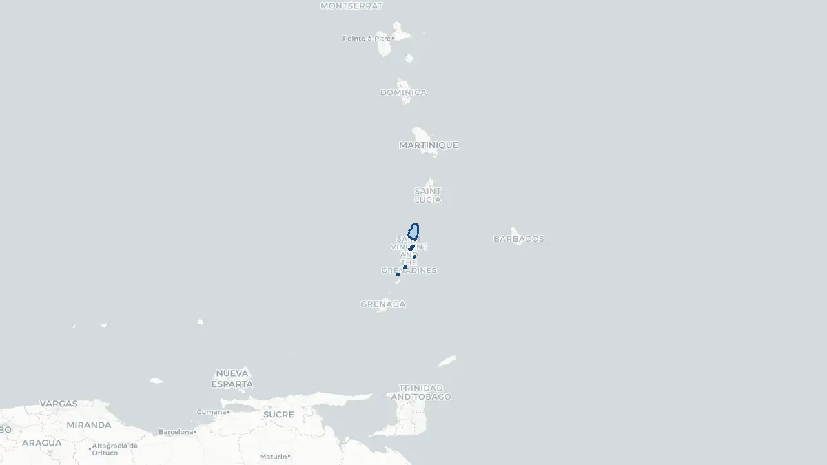
Saint Vincent and the Grenadines on the map
About Saint Vincent and the Grenadines
Saint Vincent and the Grenadines is a small island nation in the southern Windward Islands of the eastern Caribbean. It consists of the main island of Saint Vincent and a chain of smaller islands and cays collectively known as the Grenadines, which stretch southward toward Grenada. The capital and largest city is Kingstown on Saint Vincent, home to approximately 25,000 people. The country's total population is around 110,000. It is an independent constitutional monarchy with the British monarch as head of state, represented by a governor-general. The country gained independence on 27 October 1979 and is a member of CARICOM and the Commonwealth. The economy has traditionally relied on banana cultivation, but following the decline of preferential export arrangements, tourism and offshore financial services have grown. The Grenadines are a popular yachting and sailing destination, particularly the islands of Bequia, Mustique, Canouan, and Union Island. Saint Vincent was among the last Caribbean islands to be colonised, partly due to fierce Carib resistance.
Geography and Landscape
Saint Vincent covers approximately 344 square kilometres, while the Grenadines add another 45 square kilometres spread across numerous small islands and cays. Saint Vincent is a rugged, volcanic island dominated by La Soufrière volcano in the north, which rises to 1,234 metres and is the highest point in the eastern Caribbean. La Soufrière has erupted several times in recorded history, with major eruptions in 1902, 1979, and most recently in April 2021, when tens of thousands of residents were evacuated from the north of the island. The central and southern parts of Saint Vincent are also hilly and densely vegetated. The Colonarie and Yambou rivers are the main watercourses. Mesopotamia Valley in the south is fertile and productive. The Grenadines are lower and flatter, with sandy beaches, coral reefs, and calm turquoise waters. Bequia is the largest of the Grenadines at around 18 square kilometres. The Tobago Cays, a small cluster of uninhabited islets surrounded by reef, form a marine park within the Grenadines.
History
Saint Vincent was inhabited by the Arawak people and then the Island Caribs, who called it Hairouna. Columbus sighted the island on 22 January 1498, Saint Vincent's Day. European attempts to settle the island in the seventeenth century were vigorously resisted by the Caribs. The French established a settlement at Barrouallie in 1719 and developed sugar plantations using enslaved African labour. African survivors of a shipwreck near Bequia intermingled with the Caribs to form a distinct community known as the Black Caribs, or Garifuna. Britain gained control under the Treaty of Paris in 1763. The Second Carib War of 1795–1797, led by the Garifuna chief Chatoyer — the country's only national hero — ended in defeat, and around 5,000 Garifuna were deported to Roatán off the coast of Honduras. Emancipation came in 1834. The island became part of the British Windward Islands colony. It gained autonomy as an Associated State in 1969 and full independence on 27 October 1979 under Prime Minister Milton Cato. Ralph Gonsalves has served as prime minister since 2001.
Geo Quiz
Think you know your capitals, flags, and continents? Take the quiz!
Neighbouring countries
Continue to nearby countries
There are no registered neighbouring countries for Saint Vincent and the Grenadines in the current database.
More countries in the same part of the world
North America index
Open the continent hub for North America to see the full country list, capitals and frequently asked questions on one page.
Interactive map
Zoomable map of Saint Vincent and the Grenadines
Country index
All countries by continent
Jump directly to the right section or keep scrolling.
Africa
58 countries- Algeria
- Angola
- Benin
- Botswana
- Burkina Faso
- Burundi
- Central African Republic
- Djibouti
- Democratic Republic of the Congo
- Egypt
- Equatorial Guinea
- Ivory Coast
- Eritrea
- Ethiopia
- Gabon
- Gambia
- Ghana
- Guinea
- Guinea-Bissau
- Cameroon
- Cape Verde
- Kenya
- Comoros
- Republic of the Congo
- Lesotho
- Liberia
- Libya
- Madagascar
- Malawi
- Mali
- Morocco
- Mauritania
- Mauritius
- Mayotte
- Mozambique
- Namibia
- Niger
- Nigeria
- Reunion
- Rwanda
- Saint Helena
- Sao Tome and Principe
- Senegal
- Seychelles
- Sierra Leone
- Somalia
- Sudan
- Swaziland
- South Africa
- South Sudan
- Tanzania
- Chad
- Togo
- Tunisia
- Uganda
- Western Sahara
- Zambia
- Zimbabwe
Asia
52 countries- Afghanistan
- Armenia
- Azerbaijan
- Bahrain
- Bangladesh
- Bhutan
- British Indian Ocean Territory
- Brunei
- Myanmar
- Philippines
- United Arab Emirates
- Georgia
- Hong Kong
- India
- Indonesia
- Iraq
- Iran
- Israel
- Japan
- Yemen
- Jordan
- Christmas Island
- Cambodia
- Kazakhstan
- China
- Kyrgyzstan
- Cocos Islands
- Kuwait
- Laos
- Lebanon
- Macau
- Malaysia
- Maldives
- Mongolia
- Nepal
- North Korea
- Oman
- Pakistan
- Palestinian Territory
- Qatar
- Saudi Arabia
- Singapore
- Sri Lanka
- South Korea
- Syria
- Tajikistan
- Taiwan
- Thailand
- Turkey
- Turkmenistan
- Uzbekistan
- Vietnam
Europe
53 countries- Albania
- Andorra
- Belgium
- Bosnia and Herzegovina
- Bulgaria
- Cyprus
- Denmark
- Estonia
- Finland
- France
- Faroe Islands
- Gibraltar
- Greece
- Guernsey
- Ireland
- Iceland
- Isle of Man
- Italy
- Jersey
- Kosovo
- Croatia
- Latvia
- Liechtenstein
- Lithuania
- Luxembourg
- Macedonia
- Malta
- Moldova
- Monaco
- Montenegro
- Netherlands
- Norway
- Poland
- Portugal
- Romania
- Russia
- San Marino
- Switzerland
- Serbia
- Slovakia
- Slovenia
- Spain
- United Kingdom
- Svalbard and Jan Mayen
- Sweden
- Czech Republic
- Germany
- Ukraine
- Hungary
- Vatican
- Belarus
- Aland Islands
- Austria
North America
42 countries- U.S. Virgin Islands
- Anguilla
- Antigua and Barbuda
- Aruba
- Bahamas
- Barbados
- Belize
- Bermuda
- Bonaire, Saint Eustatius and Saba
- British Virgin Islands
- Cayman Islands
- Costa Rica
- Curacao
- Dominica
- Dominican Republic
- El Salvador
- Grenada
- Greenland
- Guadeloupe
- Guatemala
- Haiti
- Honduras
- Jamaica
- Canada
- Cuba
- Martinique
- Mexico
- Montserrat
- Netherlands Antilles
- Nicaragua
- Panama
- Puerto Rico
- Saint Barthelemy
- Saint Kitts and Nevis
- Saint Lucia
- Saint Martin
- Saint Vincent and the Grenadines
- Saint Pierre and Miquelon
- Sint Maarten
- Trinidad and Tobago
- Turks and Caicos Islands
- United States
South America
14 countriesOceania
27 countries- American Samoa
- Australia
- Cook Islands
- Fiji
- French Polynesia
- United States Minor Outlying Islands
- Guam
- Kiribati
- Marshall Islands
- Micronesia
- Nauru
- Niue
- Northern Mariana Islands
- Norfolk Island
- New Caledonia
- New Zealand
- Palau
- Papua New Guinea
- Pitcairn
- Solomon Islands
- Samoa
- Tokelau
- Tonga
- Tuvalu
- Vanuatu
- Wallis and Futuna
- East Timor