
Europe
Jersey — map and facts
Here you find a map of Jersey, capital Saint Helier, currency Brittiska pund and quick links to more facts about the country in Europe.
About the country
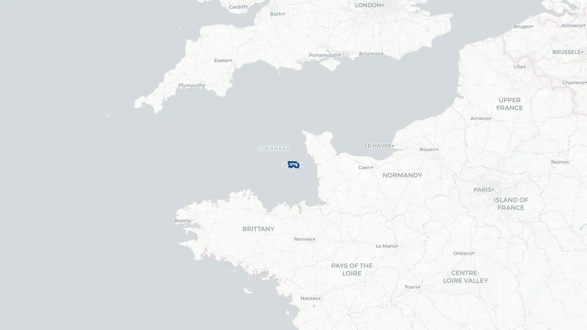
Jersey on the map
About Jersey
Jersey is the largest of the Channel Islands and is a self-governing British Crown dependency located in the English Channel, closer to the coast of Normandy, France, than to mainland Britain. Saint Helier is the capital and main town, home to most of the island's population of approximately 103,000. Jersey is not part of the United Kingdom but the British Crown is responsible for its defence and international representation. The island has its own government, the States of Jersey, its own legal system based on Norman customary law, and its own currency, the Jersey pound. The island's low-tax status and business-friendly regulations have made it one of the world's leading offshore financial centres, with banking, fund administration, and trust services being dominant industries. Jersey is officially bilingual in English and French, with the traditional Jèrriais language — a form of Norman — still spoken by a small number of inhabitants.
Geography and Landscape
Jersey covers approximately 119 square kilometres, making it the largest of the Channel Islands. The island is roughly rectangular in shape and is characterised by a varied landscape of dramatic cliffs along the north coast, sandy beaches and dunes in the south and west, and fertile agricultural land in its interior. The terrain descends from the high cliffs and plateaus of the north to the more open, lower ground in the south. The island is renowned for its exceptionally wide tidal range — one of the greatest in the world — which exposes vast areas of sand and reef at low tide, dramatically altering the coastline's appearance. The climate is among the sunniest in the British Isles, with mild winters and warm summers influenced by the proximity of France. Jersey's agricultural land has historically produced Jersey Royal potatoes and dairy products from the famous Jersey cattle breed.
History
Jersey's history is deeply intertwined with that of Normandy. Following the Norman Conquest of England in 1066, the island was part of the Duchy of Normandy and remained under the English Crown when mainland Normandy was lost to France in 1204. Jersey thereafter developed its own distinct identity, maintaining ties to both Britain and France. The island was granted a degree of self-governance that has evolved over centuries. During the English Civil War, Jersey was a Royalist stronghold and gave refuge to the future Charles II. In the Second World War, Jersey was occupied by German forces from 1940 to 1945, an occupation that left a lasting mark on the island's collective memory. Following liberation, the island rebuilt and, from the 1960s onwards, developed its financial services industry into a globally significant sector. Today Jersey is a prosperous and largely self-governing dependency with close ties to both the UK and the European continent.
Geo Quiz
Think you know your capitals, flags, and continents? Take the quiz!
Neighbouring countries
Continue to nearby countries
There are no registered neighbouring countries for Jersey in the current database.
More countries in the same part of the world
Europe index
Open the continent hub for Europe to see the full country list, capitals and frequently asked questions on one page.
Interactive map
Zoomable map of Jersey
Country index
All countries by continent
Jump directly to the right section or keep scrolling.
Africa
58 countries- Algeria
- Angola
- Benin
- Botswana
- Burkina Faso
- Burundi
- Central African Republic
- Djibouti
- Democratic Republic of the Congo
- Egypt
- Equatorial Guinea
- Ivory Coast
- Eritrea
- Ethiopia
- Gabon
- Gambia
- Ghana
- Guinea
- Guinea-Bissau
- Cameroon
- Cape Verde
- Kenya
- Comoros
- Republic of the Congo
- Lesotho
- Liberia
- Libya
- Madagascar
- Malawi
- Mali
- Morocco
- Mauritania
- Mauritius
- Mayotte
- Mozambique
- Namibia
- Niger
- Nigeria
- Reunion
- Rwanda
- Saint Helena
- Sao Tome and Principe
- Senegal
- Seychelles
- Sierra Leone
- Somalia
- Sudan
- Swaziland
- South Africa
- South Sudan
- Tanzania
- Chad
- Togo
- Tunisia
- Uganda
- Western Sahara
- Zambia
- Zimbabwe
Asia
52 countries- Afghanistan
- Armenia
- Azerbaijan
- Bahrain
- Bangladesh
- Bhutan
- British Indian Ocean Territory
- Brunei
- Myanmar
- Philippines
- United Arab Emirates
- Georgia
- Hong Kong
- India
- Indonesia
- Iraq
- Iran
- Israel
- Japan
- Yemen
- Jordan
- Christmas Island
- Cambodia
- Kazakhstan
- China
- Kyrgyzstan
- Cocos Islands
- Kuwait
- Laos
- Lebanon
- Macau
- Malaysia
- Maldives
- Mongolia
- Nepal
- North Korea
- Oman
- Pakistan
- Palestinian Territory
- Qatar
- Saudi Arabia
- Singapore
- Sri Lanka
- South Korea
- Syria
- Tajikistan
- Taiwan
- Thailand
- Turkey
- Turkmenistan
- Uzbekistan
- Vietnam
Europe
53 countries- Albania
- Andorra
- Belgium
- Bosnia and Herzegovina
- Bulgaria
- Cyprus
- Denmark
- Estonia
- Finland
- France
- Faroe Islands
- Gibraltar
- Greece
- Guernsey
- Ireland
- Iceland
- Isle of Man
- Italy
- Jersey
- Kosovo
- Croatia
- Latvia
- Liechtenstein
- Lithuania
- Luxembourg
- Macedonia
- Malta
- Moldova
- Monaco
- Montenegro
- Netherlands
- Norway
- Poland
- Portugal
- Romania
- Russia
- San Marino
- Switzerland
- Serbia
- Slovakia
- Slovenia
- Spain
- United Kingdom
- Svalbard and Jan Mayen
- Sweden
- Czech Republic
- Germany
- Ukraine
- Hungary
- Vatican
- Belarus
- Aland Islands
- Austria
North America
42 countries- U.S. Virgin Islands
- Anguilla
- Antigua and Barbuda
- Aruba
- Bahamas
- Barbados
- Belize
- Bermuda
- Bonaire, Saint Eustatius and Saba
- British Virgin Islands
- Cayman Islands
- Costa Rica
- Curacao
- Dominica
- Dominican Republic
- El Salvador
- Grenada
- Greenland
- Guadeloupe
- Guatemala
- Haiti
- Honduras
- Jamaica
- Canada
- Cuba
- Martinique
- Mexico
- Montserrat
- Netherlands Antilles
- Nicaragua
- Panama
- Puerto Rico
- Saint Barthelemy
- Saint Kitts and Nevis
- Saint Lucia
- Saint Martin
- Saint Vincent and the Grenadines
- Saint Pierre and Miquelon
- Sint Maarten
- Trinidad and Tobago
- Turks and Caicos Islands
- United States
South America
14 countriesOceania
27 countries- American Samoa
- Australia
- Cook Islands
- Fiji
- French Polynesia
- United States Minor Outlying Islands
- Guam
- Kiribati
- Marshall Islands
- Micronesia
- Nauru
- Niue
- Northern Mariana Islands
- Norfolk Island
- New Caledonia
- New Zealand
- Palau
- Papua New Guinea
- Pitcairn
- Solomon Islands
- Samoa
- Tokelau
- Tonga
- Tuvalu
- Vanuatu
- Wallis and Futuna
- East Timor