
Oceania
French Polynesia — map and facts
Here you find a map of French Polynesia, capital Papeete, currency CFP-franc and quick links to more facts about the country in Oceania.
About the country
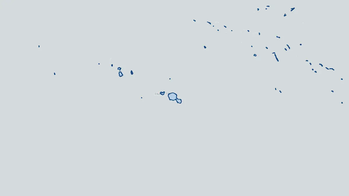
French Polynesia on the map
About French Polynesia
French Polynesia is an overseas collectivity of France scattered across a vast expanse of the south-central Pacific Ocean, covering more than 2,000 kilometres from east to west. Its capital is Papeete, located on the island of Tahiti in the Society Islands group. The total population is approximately 280,000, the majority residing on Tahiti. The territory is composed of 118 islands and atolls grouped into five main archipelagos: the Society Islands, the Tuamotu Archipelago, the Gambier Islands, the Marquesas Islands, and the Austral Islands. French Polynesia has considerable internal autonomy, with its own elected government and president of French Polynesia, while France manages defence, foreign affairs, and security. The economy depends substantially on tourism—drawing visitors with its iconic overwater bungalows and turquoise lagoons—as well as pearl cultivation (particularly black Tahitian pearls), fisheries, and French state subsidies.
Geography and Landscape
French Polynesia's islands range from high, rugged volcanic peaks to low-lying coral atolls barely above sea level. Tahiti, the largest island, rises to 2,241 metres at Mont Orohena and is characterised by dramatic ridges, lush rainforest valleys, and fast-flowing rivers. The Society Islands include Bora Bora, renowned for its turquoise lagoon and central basalt peak, and Moorea, with its deeply indented bays. The Tuamotu Archipelago comprises over 75 low coral atolls enclosing tranquil lagoons, while the Marquesas Islands are dramatically rugged, with steep cliffs and no barrier reefs. The Gambier Islands feature a large central lagoon. The climate is tropical throughout, with a warm, wet season from November to April and a cooler, drier season from May to October. Cyclones occasionally threaten the southern islands.
History
The islands of French Polynesia were settled by Polynesian voyagers over roughly 2,000 years ago, with the Marquesas among the earliest inhabited and serving as a launching point for the settlement of Hawaii and New Zealand. Europeans first encountered the islands in the 16th century; the Society Islands were explored by British navigators Samuel Wallis (1767) and James Cook (1769), who documented Tahitian society in detail. French missionaries and traders arrived in the early 19th century, and France established a protectorate over Tahiti in 1842, formally annexing the Society Islands in 1880. Other island groups were incorporated progressively. French nuclear testing was conducted at Mururoa and Fangataufa atolls from 1966 to 1996, a deeply controversial chapter in the territory's history. French Polynesia became an overseas collectivity with enhanced autonomy in 2004, and a local independence movement, led for years by Oscar Temaru, advocates for full self-determination.
Geo Quiz
Think you know your capitals, flags, and continents? Take the quiz!
Neighbouring countries
Continue to nearby countries
There are no registered neighbouring countries for French Polynesia in the current database.
More countries in the same part of the world
Oceania index
Open the continent hub for Oceania to see the full country list, capitals and frequently asked questions on one page.
Interactive map
Zoomable map of French Polynesia
Country index
All countries by continent
Jump directly to the right section or keep scrolling.
Africa
58 countries- Algeria
- Angola
- Benin
- Botswana
- Burkina Faso
- Burundi
- Central African Republic
- Djibouti
- Democratic Republic of the Congo
- Egypt
- Equatorial Guinea
- Ivory Coast
- Eritrea
- Ethiopia
- Gabon
- Gambia
- Ghana
- Guinea
- Guinea-Bissau
- Cameroon
- Cape Verde
- Kenya
- Comoros
- Republic of the Congo
- Lesotho
- Liberia
- Libya
- Madagascar
- Malawi
- Mali
- Morocco
- Mauritania
- Mauritius
- Mayotte
- Mozambique
- Namibia
- Niger
- Nigeria
- Reunion
- Rwanda
- Saint Helena
- Sao Tome and Principe
- Senegal
- Seychelles
- Sierra Leone
- Somalia
- Sudan
- Swaziland
- South Africa
- South Sudan
- Tanzania
- Chad
- Togo
- Tunisia
- Uganda
- Western Sahara
- Zambia
- Zimbabwe
Asia
52 countries- Afghanistan
- Armenia
- Azerbaijan
- Bahrain
- Bangladesh
- Bhutan
- British Indian Ocean Territory
- Brunei
- Myanmar
- Philippines
- United Arab Emirates
- Georgia
- Hong Kong
- India
- Indonesia
- Iraq
- Iran
- Israel
- Japan
- Yemen
- Jordan
- Christmas Island
- Cambodia
- Kazakhstan
- China
- Kyrgyzstan
- Cocos Islands
- Kuwait
- Laos
- Lebanon
- Macau
- Malaysia
- Maldives
- Mongolia
- Nepal
- North Korea
- Oman
- Pakistan
- Palestinian Territory
- Qatar
- Saudi Arabia
- Singapore
- Sri Lanka
- South Korea
- Syria
- Tajikistan
- Taiwan
- Thailand
- Turkey
- Turkmenistan
- Uzbekistan
- Vietnam
Europe
53 countries- Albania
- Andorra
- Belgium
- Bosnia and Herzegovina
- Bulgaria
- Cyprus
- Denmark
- Estonia
- Finland
- France
- Faroe Islands
- Gibraltar
- Greece
- Guernsey
- Ireland
- Iceland
- Isle of Man
- Italy
- Jersey
- Kosovo
- Croatia
- Latvia
- Liechtenstein
- Lithuania
- Luxembourg
- Macedonia
- Malta
- Moldova
- Monaco
- Montenegro
- Netherlands
- Norway
- Poland
- Portugal
- Romania
- Russia
- San Marino
- Switzerland
- Serbia
- Slovakia
- Slovenia
- Spain
- United Kingdom
- Svalbard and Jan Mayen
- Sweden
- Czech Republic
- Germany
- Ukraine
- Hungary
- Vatican
- Belarus
- Aland Islands
- Austria
North America
42 countries- U.S. Virgin Islands
- Anguilla
- Antigua and Barbuda
- Aruba
- Bahamas
- Barbados
- Belize
- Bermuda
- Bonaire, Saint Eustatius and Saba
- British Virgin Islands
- Cayman Islands
- Costa Rica
- Curacao
- Dominica
- Dominican Republic
- El Salvador
- Grenada
- Greenland
- Guadeloupe
- Guatemala
- Haiti
- Honduras
- Jamaica
- Canada
- Cuba
- Martinique
- Mexico
- Montserrat
- Netherlands Antilles
- Nicaragua
- Panama
- Puerto Rico
- Saint Barthelemy
- Saint Kitts and Nevis
- Saint Lucia
- Saint Martin
- Saint Vincent and the Grenadines
- Saint Pierre and Miquelon
- Sint Maarten
- Trinidad and Tobago
- Turks and Caicos Islands
- United States
South America
14 countriesOceania
27 countries- American Samoa
- Australia
- Cook Islands
- Fiji
- French Polynesia
- United States Minor Outlying Islands
- Guam
- Kiribati
- Marshall Islands
- Micronesia
- Nauru
- Niue
- Northern Mariana Islands
- Norfolk Island
- New Caledonia
- New Zealand
- Palau
- Papua New Guinea
- Pitcairn
- Solomon Islands
- Samoa
- Tokelau
- Tonga
- Tuvalu
- Vanuatu
- Wallis and Futuna
- East Timor