
Oceania
Marshall Islands — map and facts
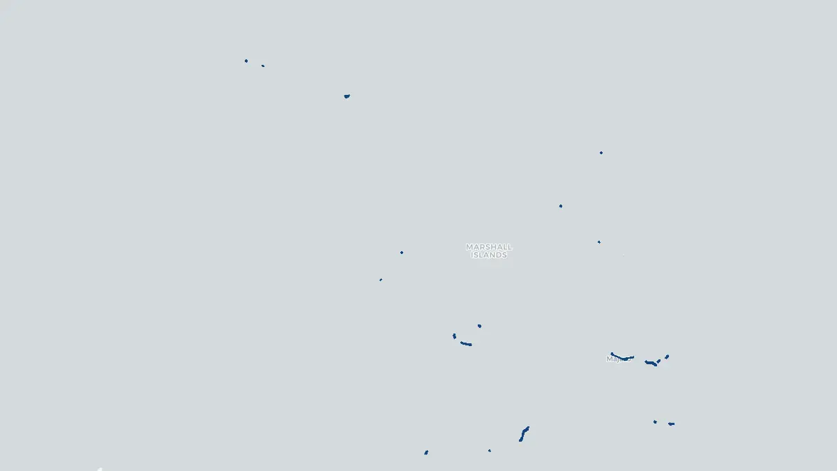
Here you find a map of Marshall Islands, capital Majuro, currency US Dollar and quick links to more facts about the country in Oceania.
About the country
Marshall Islands on the map
#### About Marshall Islands The Marshall Islands is a sovereign island nation located in the central Pacific Ocean, constituting part of the larger Micronesia region. Formally known as the Republic of the Marshall Islands, it gained independence from United States administration in 1986 under a Compact of Free Association that remains in effect today. The nation comprises approximately 1,225 islands and islets spread across 29 atolls and five isolated islands. With a population of around 42,000 people, the capital Majuro serves as the political, economic, and cultural hub. The Marshallese people have inhabited these islands for thousands of years, developing sophisticated navigation techniques using wave patterns and star charts. The country faces existential threats from rising sea levels linked to climate change, making it one of the most vulnerable nations on Earth to environmental shifts.
#### Geography and Landscape The Marshall Islands are divided into two parallel chains of atolls: the Ratak (Sunrise) Chain to the east and the Ralik (Sunset) Chain to the west. The total land area is only about 181 square kilometers, yet the islands are spread across roughly 1.9 million square kilometers of ocean. No point on any island rises more than two meters above sea level, making the entire nation exceptionally flat and low-lying. The atolls consist of coral reefs encircling shallow lagoons of turquoise water, with sandy islets dotting the reef crests. The largest atoll by land area is Kwajalein, which also contains the world's largest lagoon. The warm, clear waters surrounding the islands support rich marine biodiversity, including diverse coral ecosystems and abundant fish populations. Vegetation is primarily coconut palms, pandanus trees, and low scrub, adapted to the sandy, saline soils.
#### History Archaeological evidence suggests human settlement of the Marshall Islands dates back at least 2,000 years, with migrations from Southeast Asia shaping the original Marshallese culture. Spanish explorers made early European contact in the sixteenth century, with British captain John Marshall lending his name to the archipelago in 1788. Germany established a protectorate over the islands in 1885, administering them until Japan seized control during World War One. Japanese mandate rule lasted until World War Two, when American forces captured the islands following fierce battles at Kwajalein and Eniwetok in 1944. The United States subsequently used the Marshall Islands for extensive nuclear weapons testing between 1946 and 1958, including 67 tests that caused severe radioactive contamination, particularly on Bikini and Rongelap atolls. Displaced communities continue to seek justice and compensation. The islands moved toward self-governance in the 1970s and achieved full independence in 1986.
Geo Quiz
Think you know your capitals, flags, and continents? Take the quiz!
Neighbouring countries
Continue to nearby countries
There are no registered neighbouring countries for Marshall Islands in the current database.
More countries in the same part of the world
Oceania index
Open the continent hub for Oceania to see the full country list, capitals and frequently asked questions on one page.
Interactive map
Zoomable map of Marshall Islands
Country index
All countries by continent
Jump directly to the right section or keep scrolling.
Africa
58 countries- Algeria
- Angola
- Benin
- Botswana
- Burkina Faso
- Burundi
- Central African Republic
- Djibouti
- Democratic Republic of the Congo
- Egypt
- Equatorial Guinea
- Ivory Coast
- Eritrea
- Ethiopia
- Gabon
- Gambia
- Ghana
- Guinea
- Guinea-Bissau
- Cameroon
- Cape Verde
- Kenya
- Comoros
- Republic of the Congo
- Lesotho
- Liberia
- Libya
- Madagascar
- Malawi
- Mali
- Morocco
- Mauritania
- Mauritius
- Mayotte
- Mozambique
- Namibia
- Niger
- Nigeria
- Reunion
- Rwanda
- Saint Helena
- Sao Tome and Principe
- Senegal
- Seychelles
- Sierra Leone
- Somalia
- Sudan
- Swaziland
- South Africa
- South Sudan
- Tanzania
- Chad
- Togo
- Tunisia
- Uganda
- Western Sahara
- Zambia
- Zimbabwe
Asia
52 countries- Afghanistan
- Armenia
- Azerbaijan
- Bahrain
- Bangladesh
- Bhutan
- British Indian Ocean Territory
- Brunei
- Myanmar
- Philippines
- United Arab Emirates
- Georgia
- Hong Kong
- India
- Indonesia
- Iraq
- Iran
- Israel
- Japan
- Yemen
- Jordan
- Christmas Island
- Cambodia
- Kazakhstan
- China
- Kyrgyzstan
- Cocos Islands
- Kuwait
- Laos
- Lebanon
- Macau
- Malaysia
- Maldives
- Mongolia
- Nepal
- North Korea
- Oman
- Pakistan
- Palestinian Territory
- Qatar
- Saudi Arabia
- Singapore
- Sri Lanka
- South Korea
- Syria
- Tajikistan
- Taiwan
- Thailand
- Turkey
- Turkmenistan
- Uzbekistan
- Vietnam
Europe
53 countries- Albania
- Andorra
- Belgium
- Bosnia and Herzegovina
- Bulgaria
- Cyprus
- Denmark
- Estonia
- Finland
- France
- Faroe Islands
- Gibraltar
- Greece
- Guernsey
- Ireland
- Iceland
- Isle of Man
- Italy
- Jersey
- Kosovo
- Croatia
- Latvia
- Liechtenstein
- Lithuania
- Luxembourg
- Macedonia
- Malta
- Moldova
- Monaco
- Montenegro
- Netherlands
- Norway
- Poland
- Portugal
- Romania
- Russia
- San Marino
- Switzerland
- Serbia
- Slovakia
- Slovenia
- Spain
- United Kingdom
- Svalbard and Jan Mayen
- Sweden
- Czech Republic
- Germany
- Ukraine
- Hungary
- Vatican
- Belarus
- Aland Islands
- Austria
North America
42 countries- U.S. Virgin Islands
- Anguilla
- Antigua and Barbuda
- Aruba
- Bahamas
- Barbados
- Belize
- Bermuda
- Bonaire, Saint Eustatius and Saba
- British Virgin Islands
- Cayman Islands
- Costa Rica
- Curacao
- Dominica
- Dominican Republic
- El Salvador
- Grenada
- Greenland
- Guadeloupe
- Guatemala
- Haiti
- Honduras
- Jamaica
- Canada
- Cuba
- Martinique
- Mexico
- Montserrat
- Netherlands Antilles
- Nicaragua
- Panama
- Puerto Rico
- Saint Barthelemy
- Saint Kitts and Nevis
- Saint Lucia
- Saint Martin
- Saint Vincent and the Grenadines
- Saint Pierre and Miquelon
- Sint Maarten
- Trinidad and Tobago
- Turks and Caicos Islands
- United States
South America
14 countriesOceania
27 countries- American Samoa
- Australia
- Cook Islands
- Fiji
- French Polynesia
- United States Minor Outlying Islands
- Guam
- Kiribati
- Marshall Islands
- Micronesia
- Nauru
- Niue
- Northern Mariana Islands
- Norfolk Island
- New Caledonia
- New Zealand
- Palau
- Papua New Guinea
- Pitcairn
- Solomon Islands
- Samoa
- Tokelau
- Tonga
- Tuvalu
- Vanuatu
- Wallis and Futuna
- East Timor