
Africa
Mozambique — map and facts
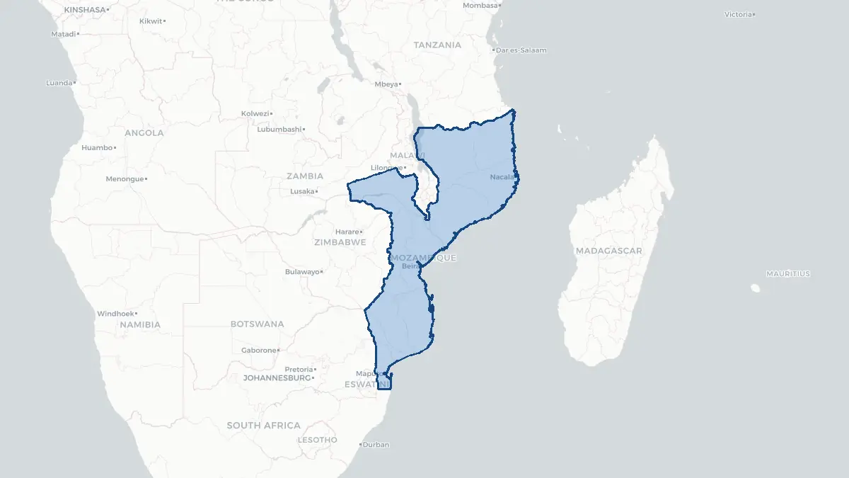
Here you find a map of Mozambique, capital Maputo, currency Metical and quick links to more facts about the country in Africa.
About the country
Mozambique on the map
About Mozambique
Mozambique is a southeastern African country with a population of approximately 34 million. Its capital and largest city is Maputo, located on Maputo Bay near the southern border with South Africa and Eswatini. Portuguese is the official language, a legacy of over four centuries of Portuguese colonial rule. The country gained independence on 25 June 1975 and immediately entered a devastating civil war between the ruling Frelimo party and the Renamo insurgency, backed by Rhodesia and later South Africa, which lasted until 1992. A multiparty democracy was established under the 1990 constitution, though Frelimo has dominated every election since. Mozambique is one of the world's poorest nations, with most of the population in subsistence agriculture; cashew nuts, tobacco, and aluminium are significant exports. However, vast offshore natural gas discoveries in the Rovuma Basin, particularly the Coral Sul FLNG facility and the Afungi LNG project, promise to transform the economy — though an Islamist insurgency in Cabo Delgado province has disrupted development.
Geography and Landscape
Mozambique stretches approximately 2,500 kilometres along the southeastern coast of Africa, facing the Indian Ocean. The country's coastline is one of the longest in Africa at about 2,470 kilometres. The terrain is generally divided between the low-lying coastal plain, which broadens in the north and south, and interior plateaus and highlands. In the northwest, the Niassa Plateau rises above 1,000 metres, while Mount Binga in the Chimanimani Mountains near the Zimbabwe border reaches 2,436 metres, the country's highest peak. The Zambezi River is the most significant waterway, bisecting the country and draining into the Mozambique Channel through a broad delta; the Cahora Bassa Dam in Tete Province is one of Africa's largest hydroelectric projects. The Limpopo, Save, and Rovuma rivers are also important. The climate is tropical, with a wet season from October to April and marked variability; cyclones periodically devastate coastal areas.
History
Bantu-speaking peoples settled the region from around 1000 CE, establishing chiefdoms that later developed into the Mutapa Empire, a gold-trading state centred around Great Zimbabwe and extending into modern Mozambique. Arab traders operated coastal settlements, and the Swahili city-states of Sofala, Kilwa, and Mozambique Island were important in Indian Ocean commerce. Portuguese explorer Vasco da Gama stopped at Mozambique Island in 1498, and Portugal established a permanent presence, using the territory primarily as a staging post on the route to India and as a source of gold and ivory. The slave trade became significant from the 18th century. Colonial borders were formalised in the late 19th century. The Frelimo liberation movement launched armed struggle in 1964; independence followed in 1975. The civil war from 1977 to 1992 killed approximately one million people and displaced millions more. Peace accords signed in Rome in 1992 ended the conflict, and multiparty elections followed in 1994. The country has faced floods, cyclones Idai and Kenneth in 2019, and ongoing insurgency in the north.
Geo Quiz
Think you know your capitals, flags, and continents? Take the quiz!
Neighbouring countries
Continue to nearby countries
More countries in the same part of the world
Africa index
Open the continent hub for Africa to see the full country list, capitals and frequently asked questions on one page.
Interactive map
Zoomable map of Mozambique
Country index
All countries by continent
Jump directly to the right section or keep scrolling.
Africa
58 countries- Algeria
- Angola
- Benin
- Botswana
- Burkina Faso
- Burundi
- Central African Republic
- Djibouti
- Democratic Republic of the Congo
- Egypt
- Equatorial Guinea
- Ivory Coast
- Eritrea
- Ethiopia
- Gabon
- Gambia
- Ghana
- Guinea
- Guinea-Bissau
- Cameroon
- Cape Verde
- Kenya
- Comoros
- Republic of the Congo
- Lesotho
- Liberia
- Libya
- Madagascar
- Malawi
- Mali
- Morocco
- Mauritania
- Mauritius
- Mayotte
- Mozambique
- Namibia
- Niger
- Nigeria
- Reunion
- Rwanda
- Saint Helena
- Sao Tome and Principe
- Senegal
- Seychelles
- Sierra Leone
- Somalia
- Sudan
- Swaziland
- South Africa
- South Sudan
- Tanzania
- Chad
- Togo
- Tunisia
- Uganda
- Western Sahara
- Zambia
- Zimbabwe
Asia
52 countries- Afghanistan
- Armenia
- Azerbaijan
- Bahrain
- Bangladesh
- Bhutan
- British Indian Ocean Territory
- Brunei
- Myanmar
- Philippines
- United Arab Emirates
- Georgia
- Hong Kong
- India
- Indonesia
- Iraq
- Iran
- Israel
- Japan
- Yemen
- Jordan
- Christmas Island
- Cambodia
- Kazakhstan
- China
- Kyrgyzstan
- Cocos Islands
- Kuwait
- Laos
- Lebanon
- Macau
- Malaysia
- Maldives
- Mongolia
- Nepal
- North Korea
- Oman
- Pakistan
- Palestinian Territory
- Qatar
- Saudi Arabia
- Singapore
- Sri Lanka
- South Korea
- Syria
- Tajikistan
- Taiwan
- Thailand
- Turkey
- Turkmenistan
- Uzbekistan
- Vietnam
Europe
53 countries- Albania
- Andorra
- Belgium
- Bosnia and Herzegovina
- Bulgaria
- Cyprus
- Denmark
- Estonia
- Finland
- France
- Faroe Islands
- Gibraltar
- Greece
- Guernsey
- Ireland
- Iceland
- Isle of Man
- Italy
- Jersey
- Kosovo
- Croatia
- Latvia
- Liechtenstein
- Lithuania
- Luxembourg
- Macedonia
- Malta
- Moldova
- Monaco
- Montenegro
- Netherlands
- Norway
- Poland
- Portugal
- Romania
- Russia
- San Marino
- Switzerland
- Serbia
- Slovakia
- Slovenia
- Spain
- United Kingdom
- Svalbard and Jan Mayen
- Sweden
- Czech Republic
- Germany
- Ukraine
- Hungary
- Vatican
- Belarus
- Aland Islands
- Austria
North America
42 countries- U.S. Virgin Islands
- Anguilla
- Antigua and Barbuda
- Aruba
- Bahamas
- Barbados
- Belize
- Bermuda
- Bonaire, Saint Eustatius and Saba
- British Virgin Islands
- Cayman Islands
- Costa Rica
- Curacao
- Dominica
- Dominican Republic
- El Salvador
- Grenada
- Greenland
- Guadeloupe
- Guatemala
- Haiti
- Honduras
- Jamaica
- Canada
- Cuba
- Martinique
- Mexico
- Montserrat
- Netherlands Antilles
- Nicaragua
- Panama
- Puerto Rico
- Saint Barthelemy
- Saint Kitts and Nevis
- Saint Lucia
- Saint Martin
- Saint Vincent and the Grenadines
- Saint Pierre and Miquelon
- Sint Maarten
- Trinidad and Tobago
- Turks and Caicos Islands
- United States
South America
14 countriesOceania
27 countries- American Samoa
- Australia
- Cook Islands
- Fiji
- French Polynesia
- United States Minor Outlying Islands
- Guam
- Kiribati
- Marshall Islands
- Micronesia
- Nauru
- Niue
- Northern Mariana Islands
- Norfolk Island
- New Caledonia
- New Zealand
- Palau
- Papua New Guinea
- Pitcairn
- Solomon Islands
- Samoa
- Tokelau
- Tonga
- Tuvalu
- Vanuatu
- Wallis and Futuna
- East Timor