
Africa
Madagascar — map and facts
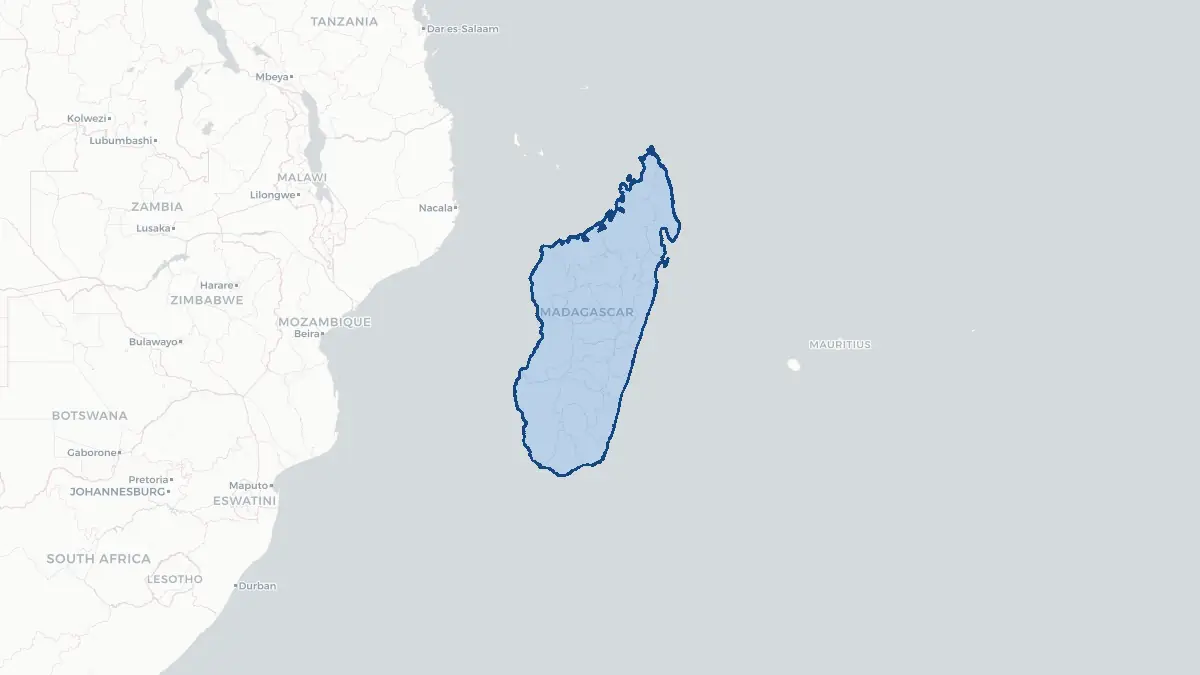
Here you find a map of Madagascar, capital Antananarivo, currency Franc/Ariary and quick links to more facts about the country in Africa.
About the country
Madagascar on the map
About Madagascar
Madagascar is an island nation in the Indian Ocean, lying approximately 400 kilometres off the east coast of Mozambique. With a population of roughly 29 million, it is the world's fourth-largest island and one of the most biodiverse places on Earth. The capital and largest city is Antananarivo, situated on the central highlands. Malagasy and French are the official languages, reflecting the island's pre-colonial Austronesian heritage and its period as a French colony. Madagascar gained independence from France on 26 June 1960 and has since experienced repeated political crises, including unconstitutional transfers of power in 1972, 1975, 2001, and 2009. The country is among the world's poorest nations, with most of the population engaged in subsistence agriculture. Vanilla, cloves, and seafood are major exports. Despite enormous natural wealth — approximately 90 percent of its wildlife is found nowhere else on Earth — deforestation and poverty pose severe long-term challenges.
Geography and Landscape
Madagascar stretches roughly 1,600 kilometres from north to south and up to 600 kilometres wide, covering about 587,000 square kilometres. A central spine of highlands runs the length of the island, with the Tsaratanana Massif in the north reaching 2,876 metres at Maromokotro, the country's highest peak. The eastern coast drops steeply to the Indian Ocean through dense rainforest, while the western coast features broad plains, limestone karst formations known as tsingy, and dry deciduous forest. The south and southwest are arid, transitioning into spiny desert. Major rivers include the Betsiboka, Tsiribihina, and Mangoky, most of which flow westward into the Mozambique Channel. The central highlands experience a temperate climate, while the coasts are tropical and subject to cyclones between November and April. The Mozambique Channel separates Madagascar from mainland Africa to the west, while Réunion and Mauritius lie to the east.
History
Madagascar was uninhabited until Austronesian seafarers from Borneo arrived between 350 BCE and 550 CE, making the Malagasy people one of the most remarkable long-distance migration stories in human history. Arab traders established contact along the northern and western coasts from around the 9th century. European contact began when Portuguese explorer Diogo Dias sighted the island in 1500. By the 17th century, the Sakalava Kingdom dominated the west, while in the 19th century the Merina Kingdom under King Andrianampoinimerina unified much of the island. His son Radama I expanded the kingdom and welcomed missionaries who introduced writing. France declared a protectorate in 1882 and colonized the island fully in 1896, exiling Queen Ranavalona III. An uprising in 1947 was brutally suppressed by French forces. Independence came in 1960, and the First Republic gave way to socialist experiments under Didier Ratsiraka from 1975. Democratic reform began in the 1990s, though political instability has persisted into the 21st century.
Geo Quiz
Think you know your capitals, flags, and continents? Take the quiz!
Neighbouring countries
Continue to nearby countries
There are no registered neighbouring countries for Madagascar in the current database.
More countries in the same part of the world
Africa index
Open the continent hub for Africa to see the full country list, capitals and frequently asked questions on one page.
Interactive map
Zoomable map of Madagascar
Country index
All countries by continent
Jump directly to the right section or keep scrolling.
Africa
58 countries- Algeria
- Angola
- Benin
- Botswana
- Burkina Faso
- Burundi
- Central African Republic
- Djibouti
- Democratic Republic of the Congo
- Egypt
- Equatorial Guinea
- Ivory Coast
- Eritrea
- Ethiopia
- Gabon
- Gambia
- Ghana
- Guinea
- Guinea-Bissau
- Cameroon
- Cape Verde
- Kenya
- Comoros
- Republic of the Congo
- Lesotho
- Liberia
- Libya
- Madagascar
- Malawi
- Mali
- Morocco
- Mauritania
- Mauritius
- Mayotte
- Mozambique
- Namibia
- Niger
- Nigeria
- Reunion
- Rwanda
- Saint Helena
- Sao Tome and Principe
- Senegal
- Seychelles
- Sierra Leone
- Somalia
- Sudan
- Swaziland
- South Africa
- South Sudan
- Tanzania
- Chad
- Togo
- Tunisia
- Uganda
- Western Sahara
- Zambia
- Zimbabwe
Asia
52 countries- Afghanistan
- Armenia
- Azerbaijan
- Bahrain
- Bangladesh
- Bhutan
- British Indian Ocean Territory
- Brunei
- Myanmar
- Philippines
- United Arab Emirates
- Georgia
- Hong Kong
- India
- Indonesia
- Iraq
- Iran
- Israel
- Japan
- Yemen
- Jordan
- Christmas Island
- Cambodia
- Kazakhstan
- China
- Kyrgyzstan
- Cocos Islands
- Kuwait
- Laos
- Lebanon
- Macau
- Malaysia
- Maldives
- Mongolia
- Nepal
- North Korea
- Oman
- Pakistan
- Palestinian Territory
- Qatar
- Saudi Arabia
- Singapore
- Sri Lanka
- South Korea
- Syria
- Tajikistan
- Taiwan
- Thailand
- Turkey
- Turkmenistan
- Uzbekistan
- Vietnam
Europe
53 countries- Albania
- Andorra
- Belgium
- Bosnia and Herzegovina
- Bulgaria
- Cyprus
- Denmark
- Estonia
- Finland
- France
- Faroe Islands
- Gibraltar
- Greece
- Guernsey
- Ireland
- Iceland
- Isle of Man
- Italy
- Jersey
- Kosovo
- Croatia
- Latvia
- Liechtenstein
- Lithuania
- Luxembourg
- Macedonia
- Malta
- Moldova
- Monaco
- Montenegro
- Netherlands
- Norway
- Poland
- Portugal
- Romania
- Russia
- San Marino
- Switzerland
- Serbia
- Slovakia
- Slovenia
- Spain
- United Kingdom
- Svalbard and Jan Mayen
- Sweden
- Czech Republic
- Germany
- Ukraine
- Hungary
- Vatican
- Belarus
- Aland Islands
- Austria
North America
42 countries- U.S. Virgin Islands
- Anguilla
- Antigua and Barbuda
- Aruba
- Bahamas
- Barbados
- Belize
- Bermuda
- Bonaire, Saint Eustatius and Saba
- British Virgin Islands
- Cayman Islands
- Costa Rica
- Curacao
- Dominica
- Dominican Republic
- El Salvador
- Grenada
- Greenland
- Guadeloupe
- Guatemala
- Haiti
- Honduras
- Jamaica
- Canada
- Cuba
- Martinique
- Mexico
- Montserrat
- Netherlands Antilles
- Nicaragua
- Panama
- Puerto Rico
- Saint Barthelemy
- Saint Kitts and Nevis
- Saint Lucia
- Saint Martin
- Saint Vincent and the Grenadines
- Saint Pierre and Miquelon
- Sint Maarten
- Trinidad and Tobago
- Turks and Caicos Islands
- United States
South America
14 countriesOceania
27 countries- American Samoa
- Australia
- Cook Islands
- Fiji
- French Polynesia
- United States Minor Outlying Islands
- Guam
- Kiribati
- Marshall Islands
- Micronesia
- Nauru
- Niue
- Northern Mariana Islands
- Norfolk Island
- New Caledonia
- New Zealand
- Palau
- Papua New Guinea
- Pitcairn
- Solomon Islands
- Samoa
- Tokelau
- Tonga
- Tuvalu
- Vanuatu
- Wallis and Futuna
- East Timor